Sunday 26 April 2009

North Walk: A Walking Week - Port Isaac to Hayle - Day 3 - Newquay to Perranporth

Day 3 Wednesday March 18th Woke up to to a foggy Newquay, which I was quite glad of - seeing as I was resembling an over-ripe tomato. Had forgotten to pack suncream - and it was proving to be one of the sunniest weeks of the year especially in North Cornwall.
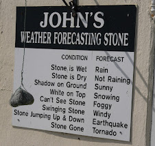
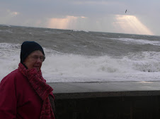
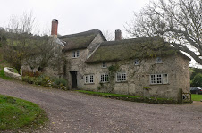
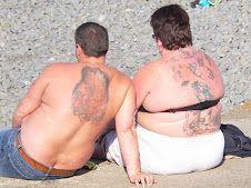
Breakfast proved eventful at The Cavendish hotel. There was a large group of wrinklies on tour and staying at the Hotel - probably the "Over 80's Nude Surfing Club" or somesuch and they were first down for breakfast, but also not far behind them were various people all sporting CCS T shirts on a Company Piss up. They staggered into breakfast looking worse for wear - some still clutching bottles of beer! One of the blue rinse brigade rose from her table, marched over to a tableful of hung over individuals and proceeded to give them a blast of her tongue - along the lines of how inconsiderate they were to have been causing a rumpus at 4am in the morning after a night on the lash. They stared at her aghast - too bleary eyed to respond - and she returned to her table to a standing ovation and hurrahs all round.

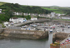
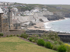
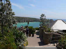
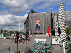
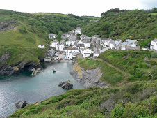
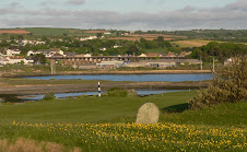
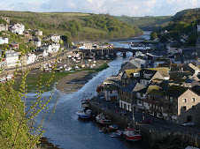
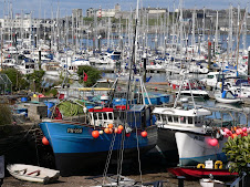
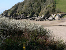
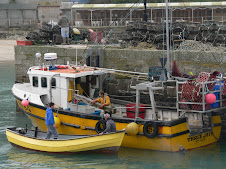
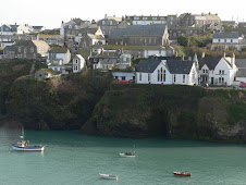
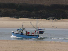
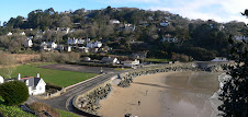
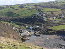
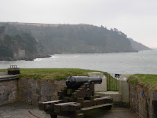
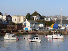
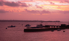
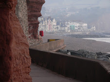
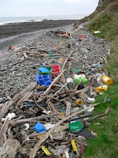
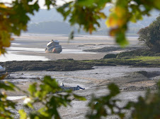
I had a slow start to the morning - I had to cross the River Gannel which is just South of Newquay and there is a walkway whcih can be accessed 2 hrs either side of low tide - so I thought that would be about 11am ish - so meanwhile - I got myself to the chemist for some Factor 50 - plus a tube of Lip Salve. Standing outside the chemist, I ripped the packaging off and chucked it in a large Council bin - unfortunately, I was left holding an empty plastic tube and had to then dip my arm into a pile of festering waste to try and find it! The path went through the centre of Newquay and past the old Harbour, so I walked down and had a look, but there didn't seem to be much happening.

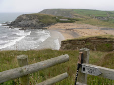
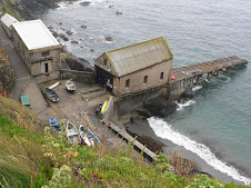
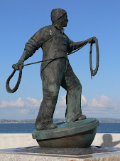
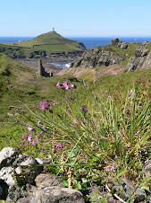
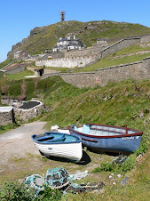
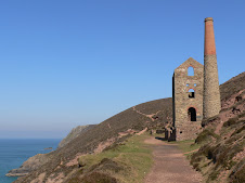
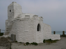
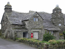
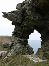
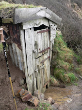
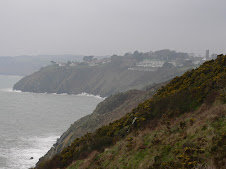
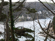
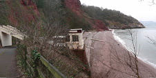
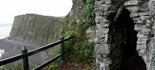
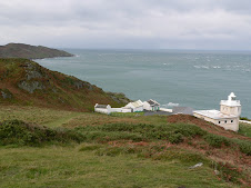
I rejoined the path and headed up towards Towan Head. At the head o the harbour was an interesting old building known as a Huers Hut. Dating back to 14th century - this was used by lookout men to spot shoals of pilchards and they then alerted and directed the local fishing boats.
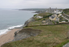
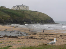
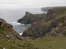
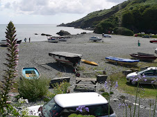
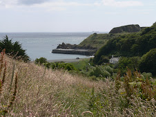
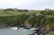
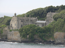
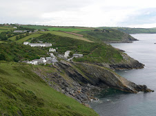
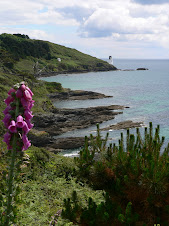
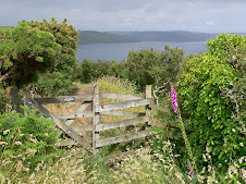
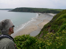
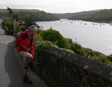
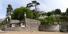
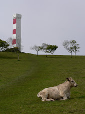
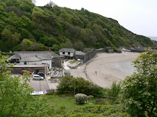
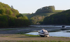
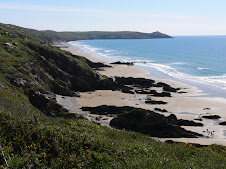
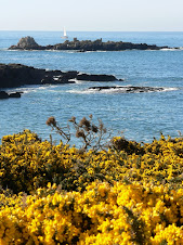
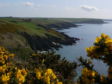
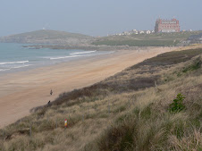
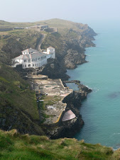
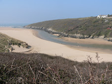
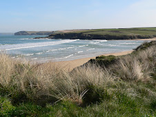
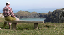
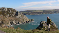
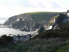
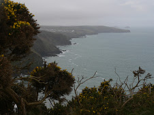
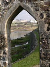
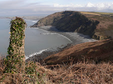
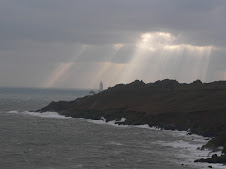
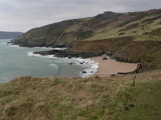
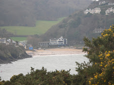
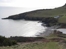
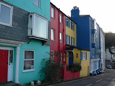
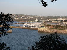
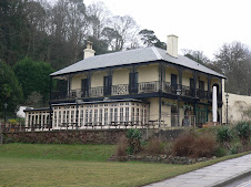
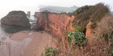
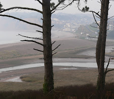
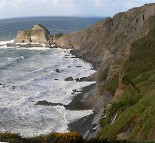
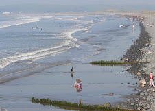
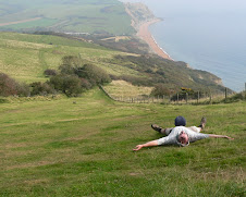
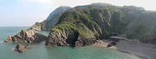
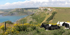
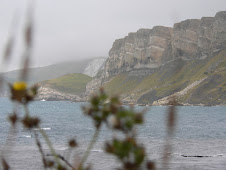
My view from Towan Head was spoilt by the fog - but it was starting burn off as I walked back from the head to the start of Fistral Beach - Newquay's famous Surfing mecca. Conditions for surfing didn't look that good, but there were a few people catching the waves at both ends of the long beach. From the far end of Fistral -the path went out towards Pentire Point East, where there was a superb house built into the cliffs with helicopter landing pad and half built swimming pool. I was now at the mouth of The River Gannel and there were several alternative routes to cross it including a small Ferry in the high season. I headed for the footbridge mentioned earlier and the path went through the suburban area of Fern Pit and there was some lovely property overlooking the estuary, which was very beautiful in the early morning sun.
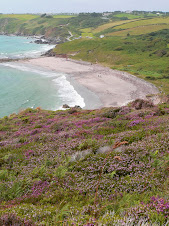
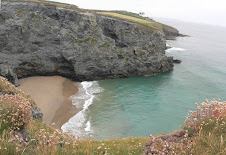
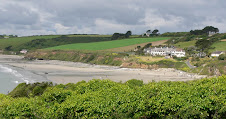
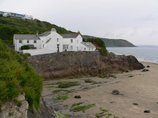
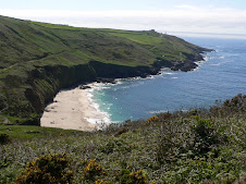
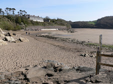
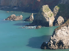
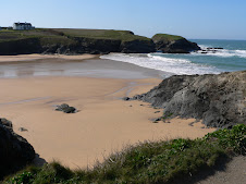
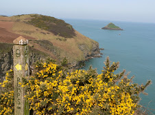
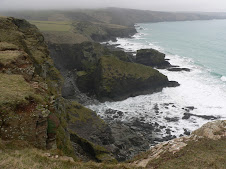
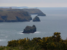
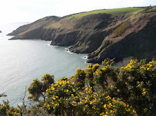
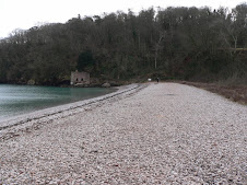
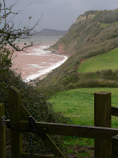
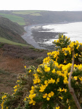
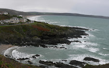
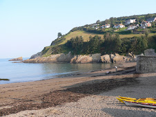
Across the river, the path then wound behind Crantock beach and climbed back up to the clifftop at Pentire point West. The small sandy bay of Porth Joke followed before reaching another popular and more secluded surfing spot - Holywell Beach. It is so named because in the past - there was a trickle of water from a small cave which was thought to have healing properties and sick children were brought along to be dipped in the water.
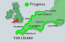
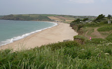
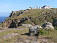
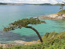
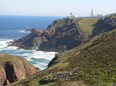
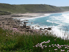
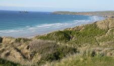
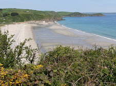
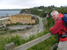
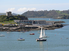
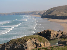
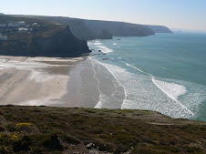
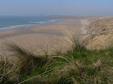
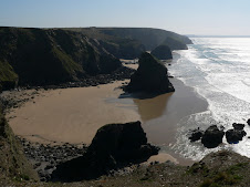
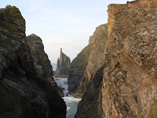
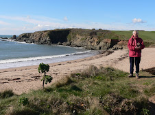
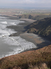
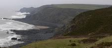
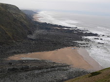
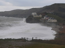
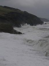
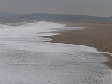
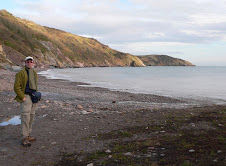
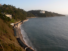
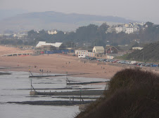
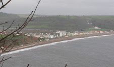
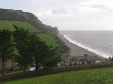
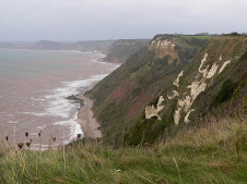
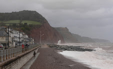
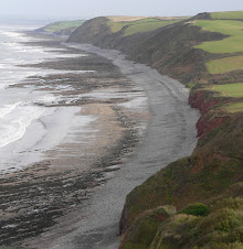
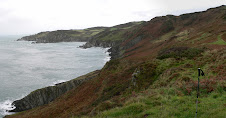
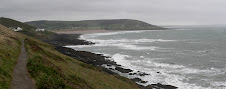
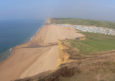
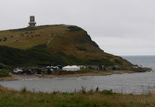
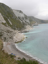
The path then skirted around a large and ugly army camp at Penhale where there were some unusual looking clifftop radar equipment, before going out to Ligger point with some great views and then you reach the massive long beach of Perran. It was then a choice of scrabbling through the soft sand of the dunes - or the firm sand of the beach - so that was a no-brainer! The beach seemed to go on forever, reminding me of Saunton Sands - but eventually I reached the small seaside town of Perranporth. Originally, I had planned to try and get to St Agnes - but I was fairly footsore, so given that there was a good choice of accommodation - I decided to call it a day. There was also a good beachside cafe - so I took the opportunity to stuff a Cream tea in my face before phoning around for a B&B.
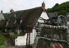
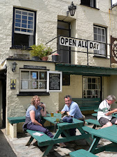
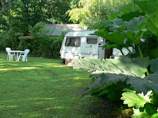
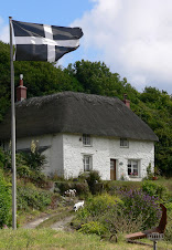
I found one - small grotty smelly single room -I was the only occupant and they were advertising NO VACANCIES - but the man I spoke to on the phone had said YES we have a room I think, but my wife deals with this and proceeded to laugh nervously! Wife wasn't amused to return from the Supermarket to find that hubby had taken someone in - she wasn't prepared! - the perils of finding accommodation, out of season! At least they had a bath. I later hit the town and tried to find somewhere to eat - the first pub stopped serving food at 6.oopm! - bizarre - but not worth employing a chef to stand around scratching his bollocks all evening, I suppose. Anyway, they recommended another much busier pub, The Green Parrot where I had an excellent meal. Probably only about 13 miles walked today - but an enjoyable hike - and I would head for Portreath in the morning.

Saturday 25 April 2009

North Walk: A Walking Week - Port Isaac to Hayle - Day 2- Trevone to Newquay

Day 2 Tuesday March 17th: As the Sole occupant at The Well Parc, Trevone - I felt a bit guilty that someone came in specially to cook my breakfast - I would have done it myself if they'd asked.
After she had cleared up, she cleared off - and the place seemed deserted. I didn't make a good start to the day - was half way down the road back to the path when I realised that the Room Key was still in my pocket - went back - only a friendly dog to greet me - gave him the key and set off again. Got to the beach and realised that my water bottle was still sitting back in my room. Tramped back in a huff - had to get the dog to let me back into my room - and made my third exit. If I'd been a scouser and not had 18 miles to walk - I could have left with the 42" wide plasma screen strapped to my back!

It was another scorcher of a day as I finally made my way, Newquay was my destination. A little further on from Trevone was Harlyn Bay and on the way, I passed a large flock of Oyster catchers quite close to shore plus another "Round Hole". I didn't look in it, but I hoped it wasn't full of Tesco shopping trolleys and fridges! Looking back - you got the best view of Trevone's Round Hole - like a scar on the cliff face.
For some miles - I had been able to see the light house at Trevose Head - and this was my first point to head for. Having rounded Cataclews Point there was the unusual sight of Padstow Lifeboat Station - seemingly built into the cliffs in the middle of nowhere.

Around the point and the Lighthouse was reached - built back in 1847 - it was a landmark that I would look back and see all day. a little further one - I was convinced that could see a Seal just off the rocks at Stinking Cove!. I spent quite awhile taking pictures - until I realised it was either a seal shaped rock - or a dead seal - still not sure which.

I was now heading due South with Mawgan Porth and then Newquay in my sights. The path passed behind the large bays of Booby's and Constantine which merged into each other -and were apparently unsafe for bathing - although they looked very inviting.

Between here and Portcothan were a series of small coves and inlets - and it was very scenic with dramatic rocks just off the beach - known as Minnows Islands.

I was soon at Portcothan, a small village which had a nice beach and was a lovely isolated spot. I didn't stop, and the path headed out towards the headland overlooking the small Trescore Islands.

The following few miles were hard work but also breathtakingly beautiful and included the wellknown landmark of Bedruthan Steps. This was my first visit, but I could see that in the Summer, it would be a major attraction - so I was pleased to see it with few people about, and on a sunny day. There were a series of sandy beaches with large rock stacks and small islets. From here, it was pretty much downhill all the way to Mawgan Porth. I was now underneath the flight path of incoming aircraft to Newquay Airport - and I was suprised at how frequent they were.
Mawgan Porth is one of North Cornwall's most popular spots and an ideal place for a coffee stop - one of the better Cappuccinno's was duly dispatched overlooking the large bay. As I left the bay - a couple of horses were taken onto the beach - and were being enticed into the sea - but it was pretty obvious that the horse did NOT want a paddle - so it was quite amusing watching the ensuing struggle - you can lead a horse to water, but you can't make it .....


A little further on, I reached the start of the long beach of Watergate Bay - one of the longest on this part of the coast. A popular surfing spot of course - it was so big - I couldn't see it ever being packed! A third of the way down the bay - the path crossed the road behind the well known Watergate Hotel where Jamie Oliver has his restaurant 15.

The path climbed back up to the tall cliffs and I now had Newquay in my sights and I was keen to get there in good time to find a suitable B&B. At the end of Watergate Bay was Trevelgue head and Porth Sands just on the outskirts of Newquay. There was a small wooden bridge which linked Trevelgue to the mainland and it used to be the site of an Iron Age castle.

I was now definitely away from Cornwall's natural beauty and had reached Cornwall's largest holiday resort - a mecca for the surfing brigade. By this time, I was well tired and looking forward to a hot bath and putting my feet up. The path eventually ended up on the main road into Newquay centre and I kept my eyes open for suitable accommodation. Down a small side road, I spotted a large and tired looking Hotel - it was cheap and cheerful - had a room with a bath - so that would do for me. The friendly old lady from up North on reception was a bit suprised at me hobbling about like a cripple, and even more suprised when I said that I had walked from Trevone, but then she probably never walks further than the Chip Shop.
Later on, I found a busy City centre pub doing a Steak and chips special with a Free Pint so I was well happy. The next day - I would head for Perranporth.

Sunday 19 April 2009

North Walk: A Walking Week - Port Isaac to Hayle, Day 1 - to Trevone

Day 1 Monday March 16th : After much consultation with online bus timetables trying to plan out my weeks walking and ferrying backwards and forwards to my car - the obvious decision was to leave the car at the start for the whole week - as I had already ascertained that I could buy a full weeks ticket at the car park in Port Isaac - so that's what I did. Another early start on the road from Uffculme - and I was back on the path at Port Isaac by 9:00am. The weather was good - and in fact the forecast was for sun all week - so I had struck lucky for once. The plan was to get to Rock and then across the River Camel by ferry to Padstow, and depending on what time it was - carry on from there to Trevone and find somewhere to stay. I was familiar with part of this coastline, from staying at Ron and Melanie Ward's bungalow at Polzeath a few years back. In fact they had been quite keen to do some walking with me on this stretch - but it didn't quite work out timing wise.
The morning's target was to get to Pentire Point - which is a magnificent viewpoint in both directions.

Before that - there was some quite strenuous walking to be done. There was only one coastal village along the way - Port Quin which was a lovely secluded place offering nothing in the way of refreshment apart from a cold water drinking tap. The village used to be quite a successful fishing village - but alot of the village was abandoned eyars ago - and now there are just a few National Trust cottages and a large stone house wonderfully positioned at the edge of the small beach commanding the best position- probably the harbourmasters house.

Another point of interest was Lundy's Hole - a natural passageway eroded through the cliff . At various points on the way to Pentire Point and what they call The Rumps - you could get a vantage point looking South West beyond the Camel estuary to Stepper Point which I would reach later in the day. The Rumps was a rocky headland stretching out Northerly and in theory the official path didn't include it - but it looked a dramatic place for a good photo - so I diverted off the path and climbed to the highest point.

Just off the point was a large rock known as The Mouls which has been home to Puffins.

From here it was a short walk round the headland to Pentire Point with some of the most far reaching views so far on this Cornish coast. I could now see Polzeath and a glimpse of Padstow itself. From here - the path was all downhill to Hayle Bay - and the sandy beach of Polzeath - another popular surfing beach. Another short walk across the cliffs brought me to Daymer Bay - and as it was low tide - I was able to take the route along the beach although it meant I missed seeing St Enodoc Church which has quite a bit of history and was apparently once completely engulfed by sand! The beach walk took me all the way to Rock itself , although I didn't see much of it - as I walked straight from the beach onto the Ferry. I was quite foot weary by now - and was looking forward to some refreshments at Padstow - a cream tea had been lingering in my thoughts for a few miles - and I wasn't disappointed. The ferry dropped off further down the estuary as it was high tide - so it was a few hundred yards back to the Harbour where I dived into the nearest Tea Room, which to my astonishment didn't seem to be owned by Rick Stein - and wasn't offering fish flavoured scones!

It recharged the batteries, and as it was quite early afternoon - I could easily make another 5-6 miles onto Trevone. I decided to see if the Tourist Office could book me some accommodation at Trevone - and between us, I found somewhere - The Well Parc Inn. I didn't really have time to look round Padstow much - but it is somwehere I've been to before, so didn't bother me.

The path left the harbour and headed out to the head of the estuary at Stepper Point which looked straight out to Pentire. It was a nice walk in the afternoon sun taking me past various coastguard cottages and also some old pilot cottages which were lived in by the men who guided vessels in and out of the estuary. The path took an inland diversion around an inlet before heading up to the tall stone Daymark at Stepper Point - which had been in view for many miles previous and was an old shipping positional aid.

A little further on - I met another hiker coming in the opposite direction - we stopped and had a chat - he had walked from Newquay and was heading for Padstow - that was probably going to be 23 miles - so he was quite knackered - but in fact as I would find out the following day - the path to Newquay was reasonably flat in comparison to some stretches.

I headed on to Trevone - the sun was going down quite quickly now and the light was superb for photography - and there were some wonderful rock formations at Gunver Head and Porthmissen. As you reach the head at Trevone Bay - there is a massive hole on the Cliff Top - which is a bizarre sight. Some genius has named this Round Hole - and they are quite common apparently - but this is a particularly large one - they are caused by sea erosion - all to do with soft rock seeping out from underneath a band of hard rock in front of it - eventually - ie a year or million later - you get a large hole which young children can fall into.
I was glad to reach Trevone and dying to get the boots off - had walked 18 miles or so - the Well Parc was half a mile from the beach - it was the locals pub as well as a hotel - the man sitting at the bar looked familiar - and he recognised me - he had served me my Cream tea at Padstow! The room was very comfortable with great views out to sea - but they'd probably given me the best one - I was the only one there!

After a good soak in the bath -I headed for the empty bar and ordered some food with a little trepidation. After a while a few locals bowled in - it was Whist Drive night - so plenty of excitement - I buried a few pints, stuffed my face with fish and chips and then headed for the pit.

Friday 10 April 2009

South Walk: Salcombe to Wonwell

Thursday March 5th. Taken a couple of days off work - so headed down to Mum and Dad's at Thurlestone to pick up the path at Salcombe again. This is a section of the path that I know very well - and has always been one of my favourite parts of Devon, but it had been quite a few years since I had walked out from Salcombe. Dad dropped me off at North Sands beach, where the path officially started again - it was a lovely sunny day, although with a bitterly cold wind and I headed past South Sands and climbed up towards the National Trust gardens of Overbeck. The Salcombe estuary has some superb properties with magnificent views, - some of the most expensive real estate in Devon. Also at Overbecks is a Youth Hostel - they really do have some prime locations - this YHA lot.

The path continued out towards Bolt Head - a prominent rocky point and then there was a very scenic stretch to Soar Mill Cove. As children we had often come to this beach, as it is very secluded and difficult to get to - but lovely once you are there. It was a steep climb out from Soar Mill Cove and feeling a bit sweaty, I made the foolish decision to take my trouser legs off!

It wasn't long before I was on the exposed stretch of Bolberry Down - and the bare legs took a pounding. There wasn't many walkers - but the few I did meet were wrapped up in Arctic clothing and some raised an eyebrow or two at the rambling loony in shorts.

Mum had decided to meet me on the path near Thurlestone and walk with me to Bantham.

I reached Hope Cove ahead of schedule - so visited the Hope and Anchor and had a ( guess what!) quick Cappuccino before meeting Mum on the footbridge beyond South Milton sands, one of Thurlestone's 3 beaches. The South Hams coast has been kept very unspoilt by the planners - so they take some credit for that - and Thurlestone has remained very untouristy, although they are just in the process of creating a new car park and shoring up the back of the beach and improving the small cafe at South Milton. Mum and I walked the well trodden path around the edge of the Golf Course - Thurlestone's main attraction, although deemed to be one of those snobby golf courses it has a great location but is very open to the elements.
Soon we were looking out towards Burgh Island off Bigbury beach as we dropped down the steep path to Bantham. The view here is superb - with all the waves rolling in towards the Avon Mouth estuary, the expanse of sand and the Island itself which is accessible by foot at low tide, and has the famous Tractor which ferries people back and forth to Bigbury when walking is no longer an option. The Island is well worth a visit - having a 650 year old Inn plus the famous Art deco Hotel once visited by Agatha Christie and features in some of her books. Not today though - once we had reached Bantham itself - we phoned for the Taxi service - which was Dad. At Bantham you are faced with crossing the River Avon - not an option even at low tide .

There is a Ferry service which runs during the peak months, but I was in the fortunate position of being given a lift over to the other side. Mum left me to it - and I got dropped off at the other side near the Bigbury Golf Course. What I thought was a quick walk down to pick up the path again at the Ferry point at Cockleridge turned out to be a 2 mile hike and I was starting to feel a bit leg weary. The aim was to reach Wonwell where there was another estuary to cross, by the end of the afternoon- and I could be picked up from Kingston - the nearest village inland.
After passing through Bigbury and then the awful mobile home eyesore of Challaborough I seemed to be suffering a leg strain - which I later put down to the wind chill bare legs factor! It wasn't a long way to reach Wonwell, but there were some steep ups and downs and by the time I had passed through Ringmore and Aymer Cove , my legs had had enough and I could see that I would be getting to Kingston very late - so I took the next inland path to Kingston which was a long and extremely muddy track .

I was praying that the pub, - the Dolphin Inn would be open with a roaring log fire, but I was disappointed and had to wait outside for my lift back to Thurlestone. Mum came armed with a can of lager and a packet of crisps - but by that time, what I really needed was a hot bath and a buxom masseuse to soothe my aching muscles!

Sunday 8th March : Annoyingly, I now had just a few miles to walk to get to Wonwell and the Erme Estuary, and it wasn't going to be worth going much further, so I decided to just make a mornings walk out of it as a round trip from Kingston back to the coast, along to Wonwell and then back inland again to Kingston. Normally, that would be a nice round trip walk to do on a Sunday morning, but for me it was alot of walking but only a few miles to add to my total! I had rested my leg strain for a couple of days anyway - so wanted to take it a bit easier AND as it happened, the heavens opened late morning - just as I got back to my car - so I avoided a big soaking. The sun was shining again and this part of the coast is quite distinct with it's steel grey steep slate cliffs - so it was a very pleasant walk. The Erme Estuary at Wonwell, looking across to Mothecombe is one of the most unspoilt estuaries on the whole of the SW path and is a lovely setting at low tide, very popular with dog walkers, in fact as a family we used to often come here and walk the dogs, particularly when my parents lived at Wrangaton. The estuary is crossable at low tide - but I would be coming back again and starting from the other side another day. It was back to Thurlestone for another Sunday Roast - ( what's this blog's web address!!)