Sunday 15 March 2009

North Walk: Tintagel to Port Isaac

Sunday February 22nd: Left Tintagel full of Bacon and Egg, it was an 8 mile stretch to Port Isaac, so not far - but once again very up and down. Before I went down to pick up the coastal path again - I went and had a look at the Old Post Office - a fantastic building from the 14th century, now owned by the Nat Trust and more interesting than the Castle in my mind.
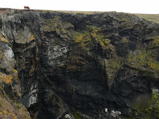
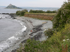
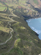
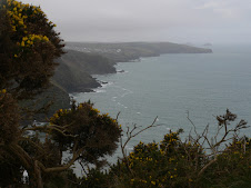
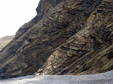
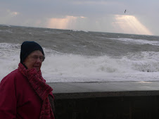
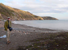
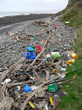
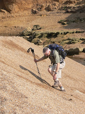
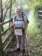
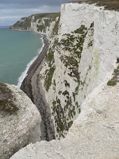
It was a very grey and damp day and once I was back on the path - there was a fine misty rain coming in from the sea. This made the path very slippy - especially as alot of it was slate - with the famous Delabole quarry, just a few miles inland. Many of the Port's along this stretch of coast had a history of exporting Slate and apart from the main quarry at Delablole - there were numerous other smaller ones dotted about. Many of the stiles were made from Slate - and also, the steps had slate divides, which as I found out very early, were extremely slippery. I had only been walking 15 minutes before I was floundering in the undergrowth legs akimbo!

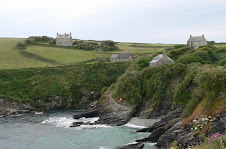
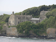
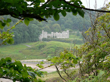
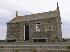
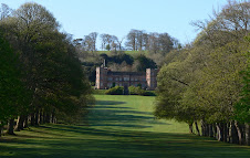
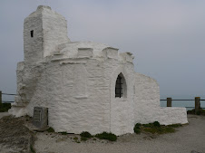
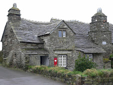
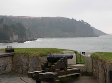
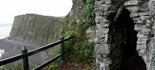
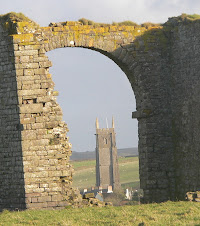
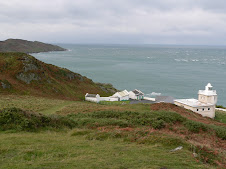
The path led up from the Castle entrance to the cliff path, passing an old Church , the oldest still in use, in Cornwall and also a Youth Hostel with a superb location on the clifftop - formerly a Quarry office.

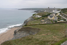
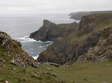
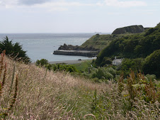
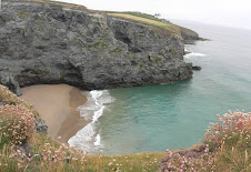
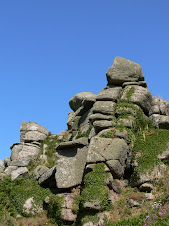
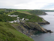
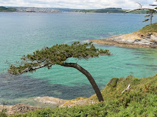
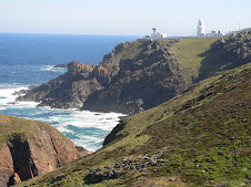
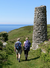
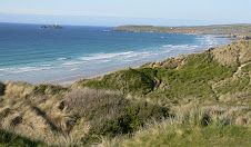
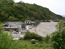
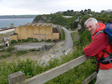
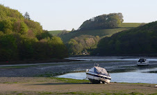
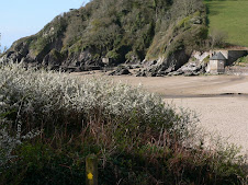
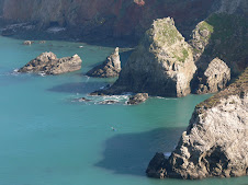
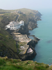
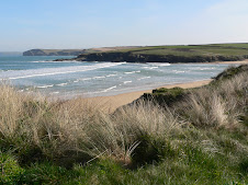
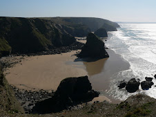
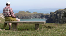
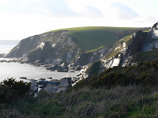
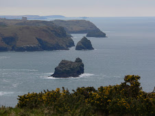
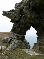
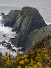
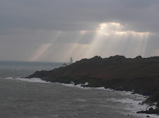
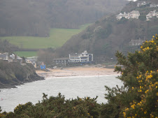
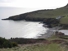
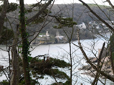
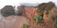
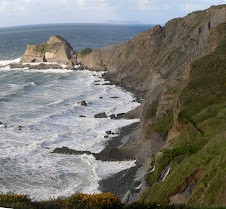
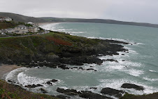
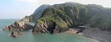
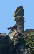
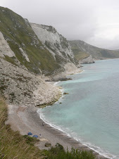
The first point of interest was Trebarwith Strand, and along the way - there were several disused coastal quarries - with one having left a large pillar of rock standing at Slate Hole.
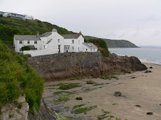
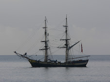
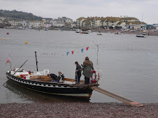
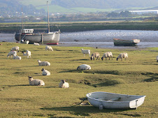
The climb down into Trebarwith was very steep, as was the climb out! It looked very scenic and was used for loading slate boats.
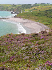
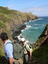
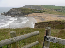
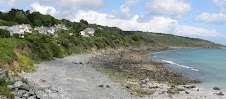
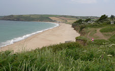
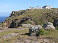
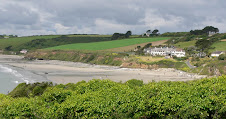
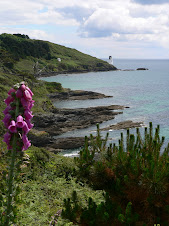
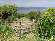
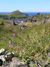
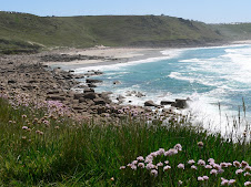
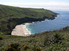
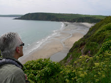
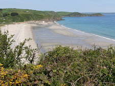
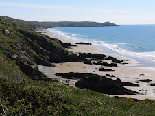
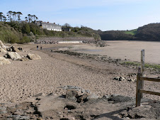
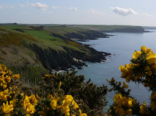
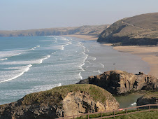
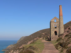
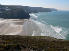
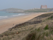
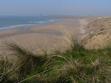
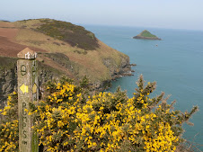
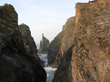
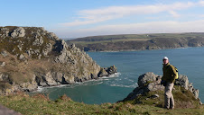
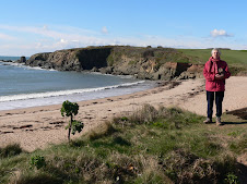
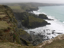
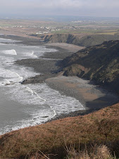
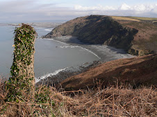
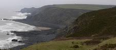
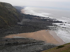
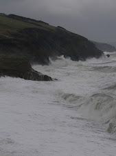
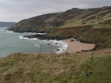
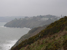
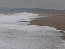
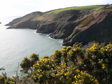
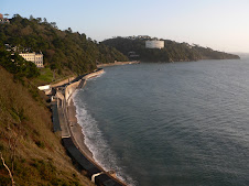
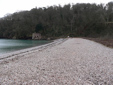
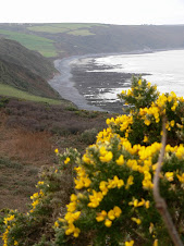
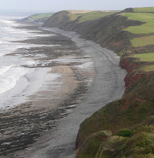
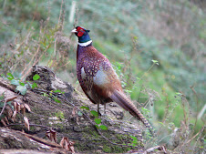
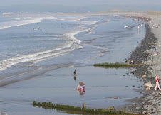
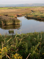
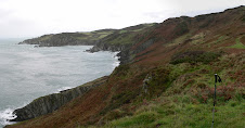
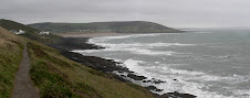
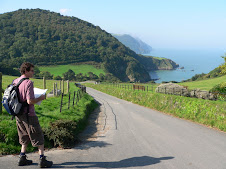
Apparently, at the height of the Slate industry - over 1000 men were employed in the various quarries in and around Delabole. Once up on Start Point, through the mist, you could just make out Port Isaac in the far distance. The path along this section included the valley of 'the Mountain' but this wasn't as daunting as it sounded. There is a large beach - Tregardock and a series of interesting rocky points and coves dominated by sheer black cliffs.
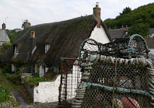
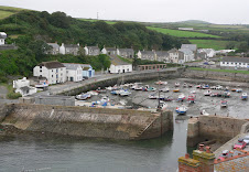
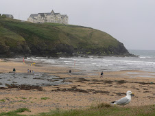
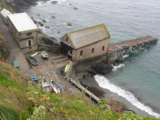
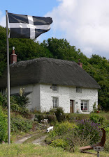
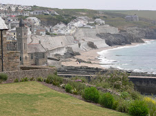
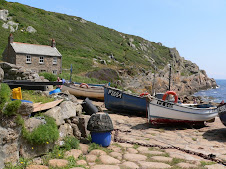
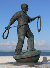
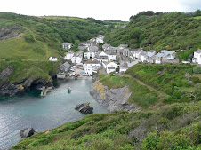
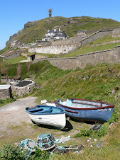
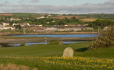
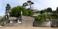
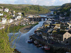
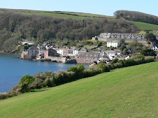
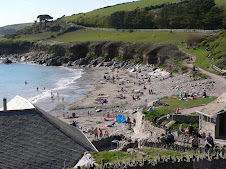
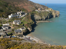
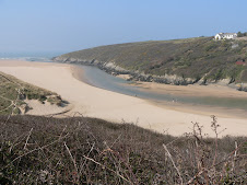
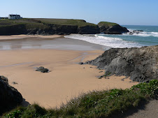
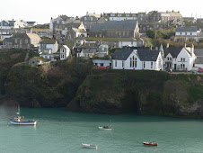
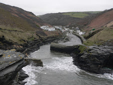
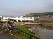
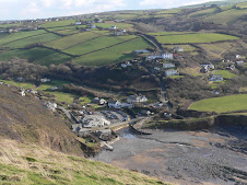
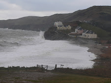
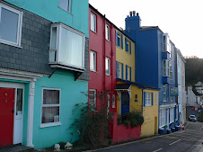
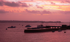
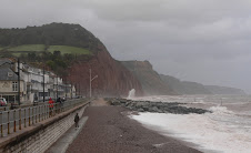
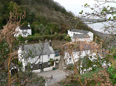
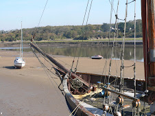
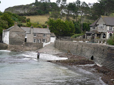
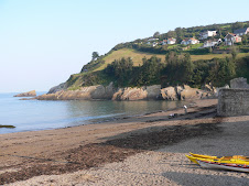
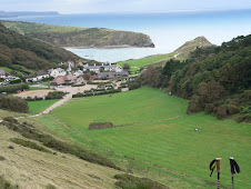
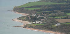
Before Port Isaac was the smaller Port Gaverne, which has an interesting history revolved around the slate industry. In days gone by, there was a pier and at loading times - up to 100 horses and many of the villagers would be used to load the brittle cargo.
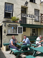
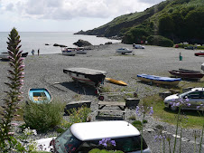
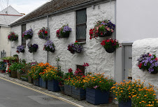
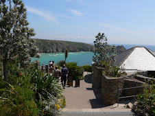
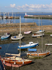
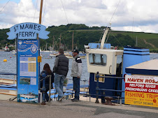
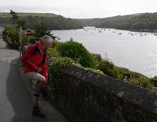
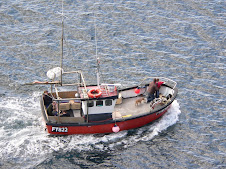
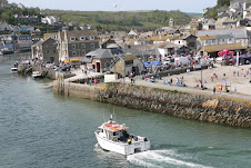
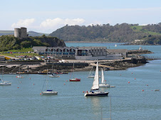
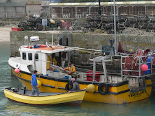
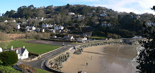
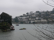
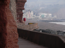
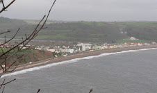
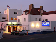
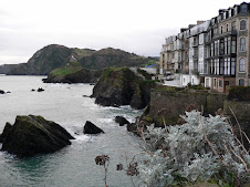
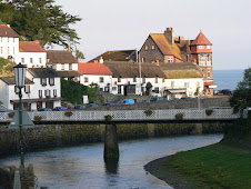
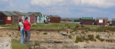
The path follows the road out of Port Gaverne and soon descends into Port Isaac. Before reaching the small beach and harbour area - it passed the high level car park - so I made sure that the car was still there and I hadn't got a ticket! - before dropping down into the narrow lanes and alleys around the harbour where there is another car park on the beach - definitely short stay!
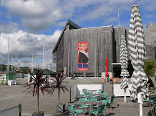
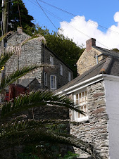
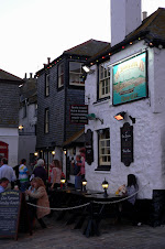
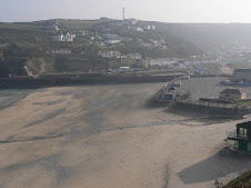
There were a few visitors about and some of the businesses were open - so I fuelled up with a welcome Cappuccino before heading back to Uffculme. It had been a good weekends' walk - interesting scenery and another 21 miles knocked off the total!

North Walk: Crackington Haven to Tintagel

Saturday February 21st: On Friday night, I had eventually managed to find a B&B in Tintagel with a bath, booked it up and arranged to be with them at 7:30am on the Saturday. They were happy to look after my car all day - and there was a 7:45am bus from Tintagel to Crackington Haven which would give me an early start. The weekend's walking revolved around transport arrangements - there are no buses on Sunday's at this time of year - so to avoid the expense of taxi's - I needed the car to be at my final destination - so the plan was to walk to Tintagel in good time to then drive to Port Isaac - Sunday's destination, leave the car there and get the bus back to Tintagel where I was staying.

I left very early - wasn't sure how long it would take me to get to Tintagel - but arrived in good time, and the bus was spot on, so not long after 8:00am - I was back at Crackington Haven - which was asleep! Ahead was a strenuous stretch to Boscastle, which included the highest cliff along the whole path - imaginatively named as High Cliff!


The path headed up towards Cambeak, a prominent high point but with severe erosion problems. The climb ahead was a steady incline up to High Cliff, with the worst walking still to come before Boscastle. This part of the coast is real Thomas Hardy territory, he worked nearby on the restoration of a local church, and High Cliff features in his book "A Pair of Blue Eyes".The walking was very much dominated by the sheer black rock cliffs and numerous nesting birds either on the cliffs or the numerous large rocks just off the coast. Apparently - there are also Seals found in large numbers along this stretch, most notably at 'Seals Hole' - a large cavern with easy access from the sea - but totally inaccessible from the land, making it the perfect safe haven. However, it was a bit early in the season, so there were no sightings.

Before Boscastle was reached - I passed through Pentargon which has a waterfall - but the path has been diverted for safety reasons, so you never get a good view of it. it was a very steep climb down and up, but then before long, you start to get glimpses of Boscastle stretching back up the valley.

Of course, your mind then goes back to the awful pictures of the floods of 2004 and I wondered how much of the devastation would still be visible.

From the cliff path - the view of the small harbour inlet is quite spectacular and it is protected by a large rocky outcrop called Penally Point from where you get a marvellous view straight up the valley.
It is a very small harbour - but was a commercial one for hundreds of years. I would have liked to have spent a bit of time in Boscastle and visited the new Heritage Centre, but with time not on my side - I decided to visit again, another time. The path headed up towards Boscastle before crossing a small bridge across to the Quayside and then back seawards to the inlet before heading up towards the prominent white watch tower at Willapark. It was going to be another 5 miles of quite tough walking before Tintagel was reached.

I walked out of Boscastle, following a fellow walker who looked all of 75yrs - but quite annoyingly, I never passed him - but then again, he wasn't taking photos! - that was my excuse anyway!
Along the way was the dramatic rocky formation known as Lady's Window and Rocky Valley.
The spectacular views were not matched by the weather - it had been another grey Cornish day.

The 5 miles seemed to be longer - but eventually, I could see the large and out of place Hotel which dominates the Tintagel skyline. The main feature of Tintagel - the castle and the legend of Arthur and Merlin's Cave, have made it a very busy tourist spot and of course the inevitable commercialisation. However, the ruins of the castle with it's dramatic setting and the fact that the town is just inland, means that the natural beauty of the coast is still retained.

The castle looks like it was built across 2 rocky islands, which were originally joined by a drawbridge. It started life as a Celtic Monastery and was also a prison. The problem with walking long distances to these places is, that by the time you get there, you are in no state for sightseeing! So I walked past the castle entrance and headed up the very steep lane to the centre of Tintagel. my day's walking was at an end - it was still early afternoon, but I needed to check in at the B&B - sort myself out, and then drive to Port Isaac and get the bus back.

When I eventually drove into Port Isaac - looking for a suitable place to leave the car overnight - I remembered that I had been here before with Suzanne a few years ago. I left the car with an inadequate ticket - but reckoned that Traffic wardens were few and far between in this part of North Cornwall!

Tuesday 3 March 2009

North Walk: Bude to Crackington Haven

Sunday February 15th: Breakfast at the Inn on the Green commenced service at 8:30am - I was there at 8:31am. It was an open plan restaurant and kitchen similar to Hell's Kitchen, and as I stood wondering where to sit ( I was the only one there) - the rather terrifying looking lady chef shouted at the top of her voice "There's a man in" and then more specifically "a man on his own". She was really communicating with the young waitress who suddenly appeared looking a bit embarrassed - I tried to lighten the mood "I'm a man apparently" Anyway, breakfast was good, there were no men in shorts and white socks and it was a lovely sunny morning.

Today's destination was going to be Crackington Haven - another 12 miles of strenuous graded coast. From Crooklets Bay which was busy with surfers - the path went across a pleasant grassy area known as Summerleaze Down before reaching Bude Beach itself and the unique Canal. I hadn't been aware of the Bude Canal - which was opened in 1825. It was quite unique insofar as instead of creating a series of locks - they built ramps on inclined planes and the barges had special wheels attached so that they could be hauled up the ramps to the next level. Commercially - the canal was never a success - but can still be accessed from the sea through a lock and plays a big part in making Bude a bit different.

I crossed behind the large Car Park behind the beach and made my way round to the sea lock from where the path left Bude to head up to Compass Point and Efford Beacon. At Compass Point was a peculiar tower which did contain the points of a compass! Built in 1831 - the builder, Thomas Acland might be a bit upset to learn that because of cliff erosion - the tower has been moved, and rebuilt but is now 8 degrees out of alignment! Polish builders probably. The views from here were superb and far reaching although it was quite hazy.

It was now a clear walk across a wide open grassy cliff to Widemouth Bay - another popular surfing spot, which was quite crowded even in February!
It seemed to consist mostly of a large car park - with people wandering about clutching boards. I didn't stop - and rejoined the cliffs to shortly reach Wanson Mouth from where, due to more erosion, the path had been diverted onto the road until the descent down to Millook Haven. The pebbly beach here was a good place from which to view the amazing geological faults and folds in the cliffs. Tectonic plate shifting approx 300 million years ago - give or take the odd month - had pushed the sandstone and shale rocks beds into spectacular chevron folds. These can be seen right along this stretch of coast to beyond Crackington Haven.
My guidebook now said " the path now stays on the cliff top all the way to Crackington"
Reading that, I may have been mistaken to think that it was a nice stroll in the sun for a few miles, but it failed to mention some very steep climbs up and down across various valleys, although with the sun still shining - the surroundings were lovely and very photogenic. Subsequently, my progress was quite slow - with numerous photo opportunities. I hadn't had such a nice day for awhile as you will have seen from the photos on this blog.
So dismissive was my path guidebook, that at one point, I thought I must have passed Crackington Haven without realising it ! A ridiculous notion - but when I was thinking that I should have reached my destination by now, I kept being faced with more severe drops into places unmentioned.
But finally, I reached Pencannow Point from which there was a tremendous view of Crackington Haven spread out below and the long stretch ahead towards Tintagel, which would be for another day.
Crackington is a very small former port which used to have a water mill and imported limestone and exported the slate from nearby Delabole. It was quite bustling with day trippers and half termers.
Public transport on a Sunday is non-existent in Cornwall at this time of year, so I had arranged to contact the taxi man I had used the day before. Finding a phone that worked was a struggle - but the very nice lady at the Combe Barton Inn let me borrow her phone - so the least I could do was sink a quick pint while I waited.
Mr Taxi man, whose name escapes me - was a mine of information about Bude and the area and I gleaned quite alot of information in a short space of time about the various characters from the Inn on the Green where my car was still parked. My lips are sealed. When we reached the Inn, the eccentric "George" was the centre of attention enjoying a pint in the outside beer garden - yet another extrordinary ornament entwined in his nicotine stained facial hair!
It had been another successful weekends' walking, I was now just 3 miles short of halfway around the whole path!

North Walk: Finally back to Hartland Quay to Bude

Saturday 14th February: I had been putting off this stretch - it was supposed to be the hardest days walk of the whole 630 miles - maybe 8 - 9hrs of walking. So apart from anything else -I was waiting for a decent weekend weather -wise. So, since the New year I have been concentrating on the Southern stretch - in fact I had reached Hartland Quay back on October 26th. It was also a difficult place to get to without transport. The last bus from Bude - my destination - was 17.00hrs and that only took you to Harland village - 3 miles away from the Quay itself. I didn't want to be rushing and worrying about the 5 o clock deadline - so in the end I decided to get to Bude at the crack of dawn - and arranged for a friendly Taxi man to ferry me to Hartland Quay. I left my car outside the "Inn on the Green" in Bude - where I had booked a room for the night - and Mr Taxi man duly arrived on cue and I was back on the path at 8:00am. Hartland Quay is a wonderful location - even on a miserable damp day. It is usually very windy - but this day - it was pretty calm - and I was banking on a dryish day.

At this point - I might mention that you won't see any photos from the first 2 hrs or so of my walk - as at the end of the day, when my camera card was full - I managed to delete them by mistake!!! - Plonker - first time I've done that - must have been tired.

Hartland Quay has an interesting past - it had been a working harbour up until the 19th Century and had 3 lime kilns and a Malt House. The amount of trade and commerce warranted opening a small bank which operated until 1833. The Inn has had several names over the years - and was once closed due to excessive drinking - I wasn't there - honest.

The first part of the walk to Speke's Mill Mouth - I had done before. After heavy rain - there is a dramatic waterfall here - but you only get a really good view of it from the beach - and with a long walk ahead of me - I didn't make the detour.

Apparently - I would be crossing 8 valleys during the day's walk - all from high cliff points. The scenery over the whole stretch of North Devon has been splendid - and today was no exception - and infact I was soon to cross the border into Cornwall.

The first place to head for was Welcombe Mouth. On the way, I disturbed a Buzzard on it's prey - a rather mangled looking rat, I think - didn't examine it too closely.
The drop down to Welcombe Mouth and the valley of Strawberry Water was very steep. Welcombe Mouth was one of the few easily accessible parts of the coast on this stretch and there were some surfers getting ready to ride the waves.

A steep climb out of there and before I knew it - I was on the way down again towards Marsland Mouth and halfway down the path was a small stone building which my guide book assured me would be open and where water is provided daily! It was a seaside bolthole for the writer, poet and playwright, Ronald Duncan - known mostly for his work with Benjamin Britten and for being a staunch pacifist. In the early 1900's he set up a Co-operative farming enterprise near Welcombe - but this ultimately proved a failure. I might have got this information from his stone hut - but it was firmly CLOSED.
At Marsland Mouth, a small bridge took you across the River Marsland - and you pass from Devon to Cornwall in a few strides. At Marsland Beach - there was yet another waterfall.

For the next hour or so - it seemed just a succession of ups and downs to small mouths and included a long climb up to Henna Cliff - the second highest sheer cliff drop in England - second only to Beachy Head. Shortly I reached the turn off to Morwenstow - a small village with pub and cafe - but not open at this time of year. I knew I was about halfway to Bude at this point - some people split this section in to two and halt at Morwenstow. I was making good progress and felt particularly energetic for some reason. A little further on - there was a National Trust Sign pointing the way to "Hawkers Hut" This was a small hut made out of driftwood by the Reverend Hawker - the rector of Morwenstow Church in the 1830's - where he used to sit smoking Opium in quiet contemplation. Hawker was a legendary eccentric. He is known to have dressed up as a mermaid and excommunicated his cat for mousing on Sundays. He dressed in claret-coloured coat, blue fisherman's jersey, long sea-boots, a pink brimless hat and a poncho made from a yellow horse blanket. He frequently talked to birds, invited his nine cats into church and kept a huge pig as a pet.
Just a regular sort of guy - his main claim to fame was to be the man behind the institution of Harvest festivals.

The path zig zags on down to Tidna Shute before reaching Higher Sharpnose Point - where you could walk out on a very narrow path to have a superb view inland with outreaching views of large parts of the coast in both directions - see rain splattered panoramica below.

I had about an hour of light rain now - but just got my head down and pressed on. The steep descents and lung busting climbs seemed to go on and on. What made it worse was the condition of the paths which were often a quagmire - and made the walking even more difficult. Some of the paths were obviously used by horseriders - and with all the rain, they had churned them up. After a while - shortly after passing across a scenic valley known as Duckpool I was looking at a large stretch of sands which seemed to go the whole distance to Bude and I got the impression that the worst of the walk was over. This was Sandy Mouth - obviously a very popular spot confirmed by the National trust cafe and car park. It was a beautiful sight - the sands and waves rolling in and there were plenty of dog walkers taking advantage. The path passed along the grassy low cliffs behind and the walking was fortunately much easier. It was only another 3 miles to Bude now. The B&B that I had chosen was at Crooklets Bay which was on the Northern outskirts of Bude itself - and my walk for the day virtually ended at it's front door, which I was glad of. Before that - as I was stumbling down the path thinking of a hot bath - I bizarrely bumped into someone I knew - Steve Lewis from Fourway print - out walking his father's dog. I apologised for looking like a tramp - I had only just scraped myself off the path having completely lost my footing and sat down in a bog!

At the hotel - I peeled off my boots and left them outside - an older couple were booking in at the same time - and the woman seemed quite appalled at the vision in front of her - Smelly wet socks - and a seatful of mud.
It was 15:30pm - I had done it in 7.5 hrs, so was quite pleased at that - and back well in time to have a good hot bath and still see England play Wales in the 6 Nations.
I was reminded that I was now in Cornwall - when I discovered that all the male members of staff were wearing black, below the knee shorts, white socks and trainers! - bizarre. The Bar was a good place to watch the rugby - and I stayed and enjoyed a decent meal. One resident at the bar took my attention - he was an old tramp of a man with long scruffy grey hair, but amazingly, with a bright red heart shaped bauble hanging from his straggly beard. He turned out to be the local village oddity - called George ( they are always called George) - and was obviously on the pull!
There was going to be a Valentines Disco, but unlike George, I wasn't up for that - and crashed out for an early night. 15 hard miles done - another 12 to do the next day.

Monday 2 March 2009

South Walk: Torcross to Salcombe

Sunday February 1st: I had my own private Taxi service today - Mum and Dad - the forecast was looking a bit dodgy with tremendous winds although staying dry. Having checked it out - it seemed that the wind would be behind me most of the way - but it was pretty cold. So M&D kindly got up a bit earlier than they might normally and we got to Torcross for 9:00am. It was blowing an absolute Hooley - with thunderous seas as Mum joined me on the front at Torcross, struggling to stay upright.


It was a 13 mile walk to Salcombe - one which I wasn't particularly looking forward to given the conditions - but I left Mum holding on to her hat and climbed the steps out of Torcross next to a row of attractive houses and a Cafe which must get pounded every Winter with the full force of the sea. The next point of call was Beesands to be followed by Hallsands. Beesands has a small Ley behind the beach and alongside a scattering of houses. The spray from the pounding seas was blowing a long way inland - so there was no escaping a soaking. I wasn't lingering - so kept full steam ahead across Tinsey Head towards Hallsands. The path here went across the back of the beach which was still being washed by the vigorous waves - so I had to pick my way across at the right time to avoid a soaking. The original site of Hallsands village was right at the seas edge - but was pretty much destroyed by 2 storms in the early 1900's - so is now just ruins which you can get a glimpse of. A new small development of smart marineside properties has been built overlooking the bay with the main village now being slightly inland.

The path headed away from Hallsands up onto the cliffs heading for the Lighthouse of the very prominent Start Point. Here it was actually quite difficult staying upright with the wind blowing straight off the sea.

It was such a horrendous day, weather wise - that I wasn't expecting to see too many weekend walkers - but I did spot a lone car parked at the Start Point Car Park - and a few miles later, met 2 young guys who were hoping to walk to East Prawle and get a bus back! - On a Sunday - not a hope in hell - so I put them straight on that and suggested they would just have to turn round and walk back. I could have walked with them - but to be honest I was wanting to make quick progress - so didn't want to be held up.

From here to East Portlemouth across from Salcombe - is some of South Devon's finest coastline - very dramatic - but would have been so much better if the sun had been shining! Although - a coastal walk in extreme winter conditions is always very exhilirating. The wind was blowing me on from behind which I was glad of as I headed for Lannacombe Bay. I couldn't remember walking this part of the coast before - although I am familiar with most of the South Hams coastpath. I did recognise the Maelcombe House - a very large Estate house with sweeping lawns ending right at the cliff edge- a superb location but very exposed. My next milestone was going to be Prawle Point where there was a Coastwatch Lookout Point. I was ready for some lunch - but needed to find somewhere sheltered as it was so cold in the wind. It was only later in the afternoon when I was back at Thurlestone that Mum said " Why didn't I pop in and see the man at the Coastal Lookout Station" - apparently - he quite likes having visitors - might even have made me a cup of tea! I thought he would have probably told me to bugger off - so I found a large rock to crouch behind instead.

Suitably refreshed and feeling quite cold - I quickly got back in my stride continuing towards Gammon Head and Gara Rock. The former large Gara Rock Hotel is no longer in existence - it used to be a good place to walk to from East Portlemouth on an inland path. The path went around the back of the beach at Gara, Seacombe Sands and from there the path undulated around various rocky points with various small coves towards the mouth of the Salcombe Estuary.

Salcombe is rightly the jewel in the South Hams Tourist crown. It is also the place that we used to come to on holiday back in the 70's - and subsequently having fallen in love with the area - Mum and Dad decided to move lock, stock and barrell to the South Hams, although it is only in recent years that they are now right on the coast. Mill Bay and the beaches in close proximity were always a favourite of mine - catching the ferry across from Salcombe.

As I walked around the point and into the estuary - Salcombe was a welcome sight - and I was hoping that the Ferry would be running. I had made good time - and was over an hour earlier than I thought I would be. The path passed across the back of Mill Bay with views across to North and South Sands - and then went up onto the road into East Portlemouth. I dropped down the steps to the Ferry Point - no sign of any ferry activity - but suddenly at just before 2:00pm a few other people turned up and I could see the Ferry leaving Salcombe. It seemed colder than ever - but probably because I had stopped walking. It was a choppy dash across the estuary - one chap got absolutely soaked by a wave. Once across - I dived into the Harbourside pub and ordered a welcome pint and savoured the log fire. Phoned Mum and Dad who were very suprised that I had arrived back already and by the time they arrived to pick me up - I was in a little cafe enjoying a hot Cappuccino.

South Walk: Dartmouth to Torcross

Saturday 31st January: I'm getting used to the early Saturday starts now. It was a cold windy one - headed straight to Torcross - the cunning plan was to leave the car there and get the first bus of the day to Dartmouth harbour. Got there in good time - once again met the "convenience facilitators" at the public car park - I keep bumping into them - that's the people who have the splendid job of being responsible for opening up the Public Toilets first thing in the morning! Someone's got to do it.

I parked right next to Slapton Ley nature reserve - a well known attraction for bird watchers and conservation area. It was a nice ride on the top deck of the bus back to Dartmouth from where I headed out from Bayards Wharf and up towards Warfleet and Dartmouth Castle. I took the lower path which ends up at the Castle itself and St Petrox Church. The Castle is 15th Century and now owned by English Heritage. In the Summer - you can get a ferry straight to the Castle from Dartmouth harbour. There was a little Cafe open at the entrance and a couple of dog walkers making good use of it - one of whose dogs seemed to to to take exception to my presence. There were several signs exclaiming SAVE CASTLE COVE and a lady explained that after bad storms awhile back the path to a small cove at the foot of the castle had been destroyed and they were campaigning to get the council to restore it - as it was a popular and safe bathing place for the local residents.

I pressed on - it was a miserable drizzly grey day - and the path headed out to Blackstone Point at the mouth of the Estuary with good views across to Kingwear Castle. At some point I somehow missed a turn off and was gaily heading along a well trodden path towards Redlap for a mile or so before I realised that I hadn't seen the well know Acorn path symbol. An old gentleman was heading towards me - and I made the mistake of trying to explain that I thought I was on the wrong path and of course he couldn't understand why I was insisting that I was going to have to head back in the opposite direction to where I was headed because I had in effect missed out a portion of the path.

Anyway - that's what I had to do and eventually I was back on track. This was quite a scenic section of the coast - but what followed was an unfortunate detour inland to Stoke Fleming missing out a whole section of coastline which was obviously privately owned with no public access.

At Stoke Fleming - they have tried to improve the route through the village - and only ended up confusing the whole thing with signposts all over the place - and I ended up heading out of the village in the wrong direction - so it wasn't a good morning all round. The path was on the main road for awhile before spurring off to drop down to Blackpool Sands - a very popular summer destination.
The Venus Cafe - part of a Group which open all year round - was a convenient coffee stop although it was too cold to hang around long.

From the Sands - the path climbed up following the road - giving lovely views of the bay and then dropped into Landcombe Valley. This section was relatively new having been opened in 2005. There were a few small coves that you could spot further down -but then the path again headed inland towards Strete picking up the main road again. From here it was a straightforward walk down to the start of the long Slapton Sands and along to Slapton Bridge at the start of the Ley Nature Reserve. The sea was pounding in as the wind got up on this exposed stretch. From here it was still another 3 miles to Torcross the path following the edge of the Ley and parallel to the beach. This is a popular spot for Dog walkers and weekend wanderers alike. I could have carried on really given it was early afternoon - but the path headed away from the bus route - so there wasn't any convenient stopping places before Salcombe 13 miles away! - and that was going to be the next day's walk. Torcross, of course - is famous for the American Sherman Tank which sits in the corner of the Car Park - it was used in D day landing practices on Slapton beach - was lost at sea - but then recovered in 1984 and acts as a memorial to the many American lives lost during the landing practices.
So back at the car park, I headed off to Thurlestone to take advantage of Free B& B facilities with Mum and Dad - another 11 miles done.