Sunday 16 August 2009

Final South Walk: Coverack to The Lizard

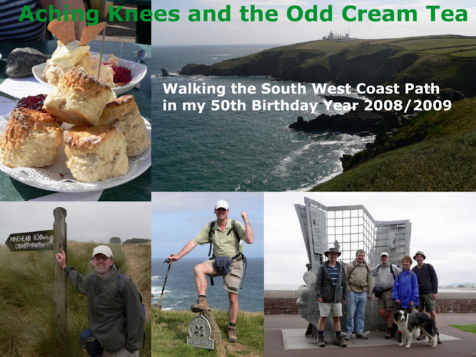
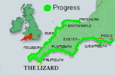
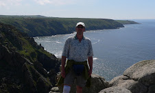
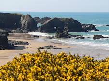
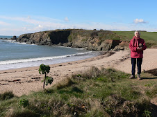
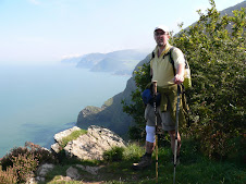
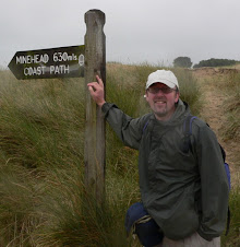
Sunday July 19th: Today was the final leg of my 630 mile mission to walk the whole of the SW coast Path - not in one go, but in stages throughout the year. I had started it on the weekend of August 8th, 2008, and committed myself to completing it within my 50th birthday year. Unusually, I had decided to walk it from both the start and the finish in opposite directions - finishing at The Lizard which is near enough halfway. Also raised some money for the David Shepherd Wildlife Foundation along the way!

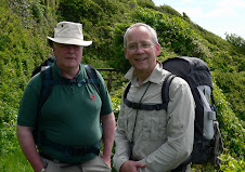
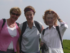
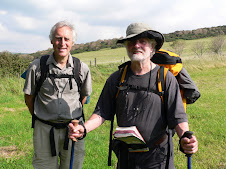
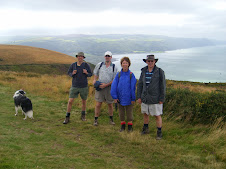
For my last day of walking, I had been joined by my friends Jeff and Marie Weeks and we stayed overnight at Cadgwith, a small fishing cove nr the Lizard on the Saturday. I had explained to J & M, that apart from just finishing the walk- I was also on a mission to see Dolphins, which had been noticeably absent on the previous 618 odd miles of walking. AND having just missed seeing a Cornish Chough near Lands End, and subsequently finding out a bit more about them ( they are birds!) - I knew there was a breeding pair on the Lizard somewhere - SO - that was the second mission - "Spot the Chough" Eyes would be peeled!

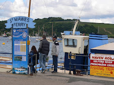
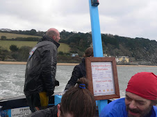
The first problem was to organise transport - the Bus Services were limited particularly as it was a Sunday. In the end, it was easier all round to get a Taxi from the Lizard to Coverack, our starting point and leave Jeff's car at The Lizard.

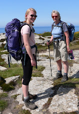
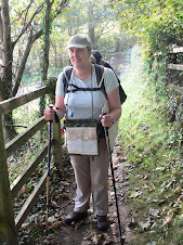
It was a relatively short stint of 10-12 miles to be walked, but with a fair few ups and downs. Jeff and Marie weren't regular walkers, but were looking forward to getting a bit of a taste of the Coast path. (Marie had packed enough goodies for an assault on Everest - but we were glad of it later!)

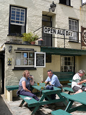
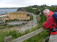
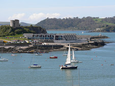
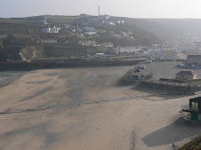
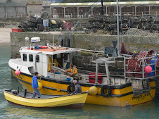
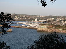
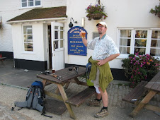
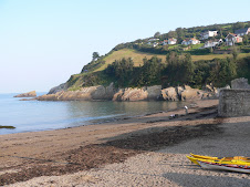
Meanwhile, we had had a hearty full English at the Cadgwith Cove inn which needed to be walked off. I had last ended my walk at Coverack at the Paris Hotel near the harbour on Dolor Point, so this was where we started from. It was a lovely sunny day - but forecast for a few showers later.
After a quick bladder check we set off in tandem, with Jeff setting a cracking pace at the front.

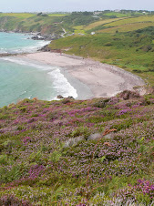
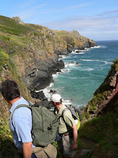
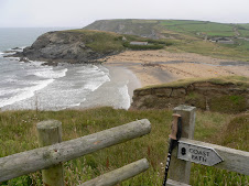
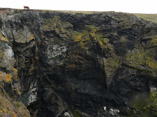
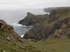
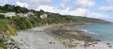
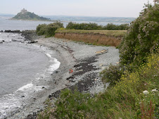
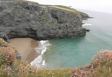
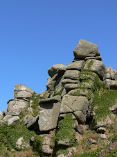
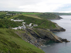
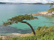
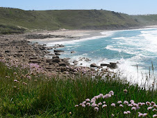
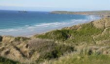
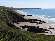
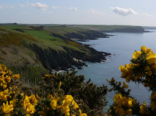
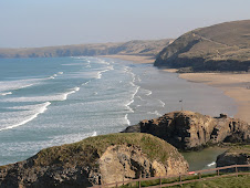
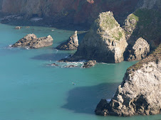
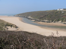
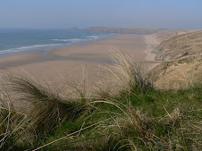
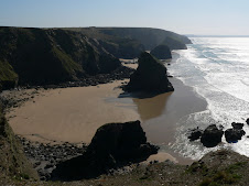
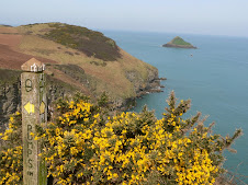
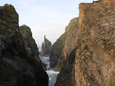
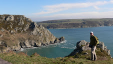
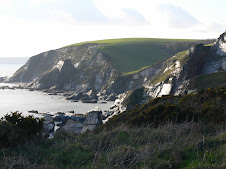
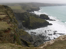
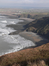
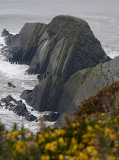
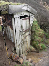
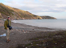
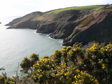
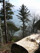
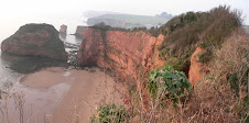
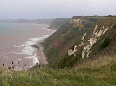
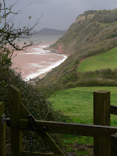
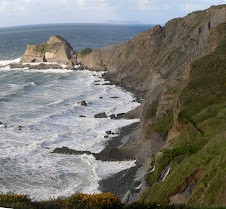
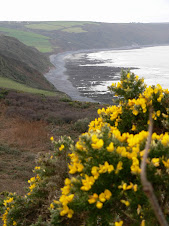
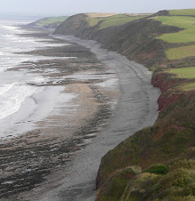
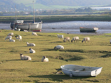
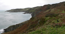
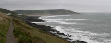
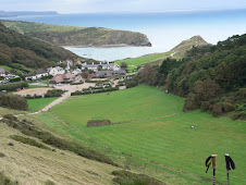
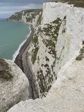
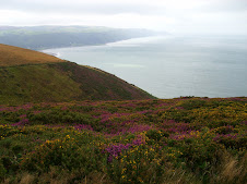
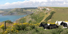
The path climbed steeply out of Coverack and then followed the cliff around to Perprean Cove and onto the rocky outcrop of Chynalls Point. It was good walking weather, not too hot but very windy. The views were good as we headed towards Black Head, with it's disused Coastguard look-out hut and then ascended steeply into Downas Valley. Our first target destination was Kennack Sands which would be about our halfway point and a good place for a coffee stop. So far, so good - after a few miles, Jeff and Marie were still blisterless, both had dodgy joints to look after - Jeff with his knee, still recuperating after keyhole surgery last year and Marie with her Netball Ankle injury!

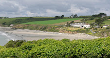
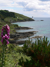
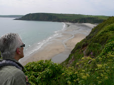
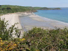
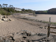
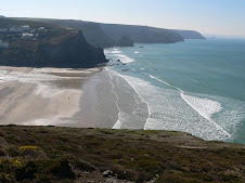
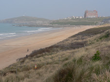
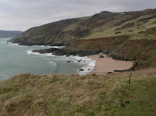
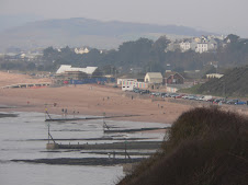
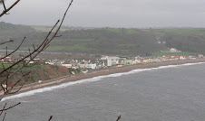
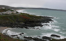
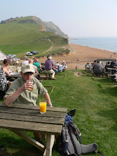
As we approached Kennack Sands across the gorse and heather of Eastern Cliff - the clouds gathered ominously. There are two beaches at Kennack - North and South and by the time we approached the Southern beach, the one with the cafe's it was raining quite heavily. Fortunately after a nice coffee break, the rain had passed and it was onward and upward.

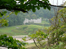
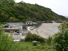
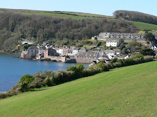
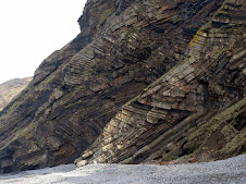
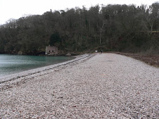
We soon reached a little place called Poltesco and Carlean Cove which used to have a thriving Pilchard fishery. In the 1860's some of the fish cellars were converted into a factory for producing ornamental products form the local rock, Serpentine. At one point up to 20 people were employed and products were taken by barge to ships in the bay for distribution. The old buildings are now owned by the NT.
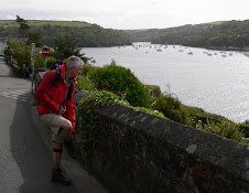
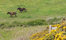
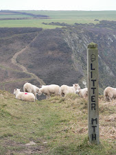
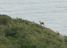
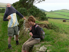
We were now not far from Cadgwith Cove where we had stayed the previous night. As we passed around Enys Head - we met a group of 6 wild Ponies. One of them made a bee-line for us and seemed intent on following us. Marie shot off like Usain Bolt with Jeff in pursuit. I tried to halt the beast with a pat on the nose - he was just after some of the goodies in our backpacks, but we fooled him with a pincer movement in opposite directions and he lost interest.

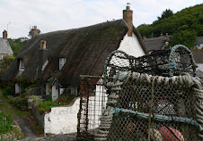
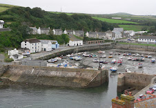
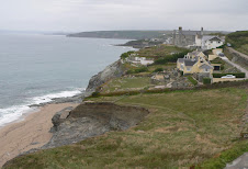
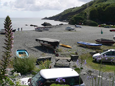
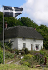
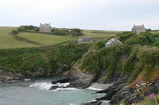
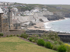
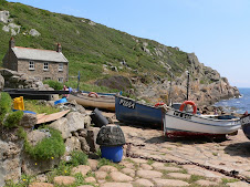
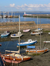
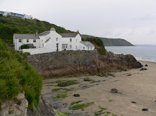
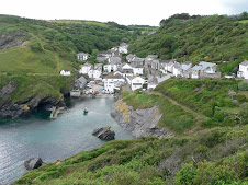
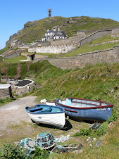
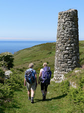
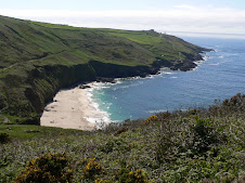
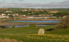
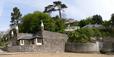
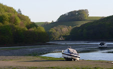
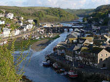
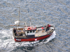
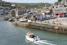
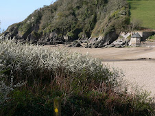
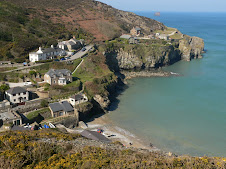
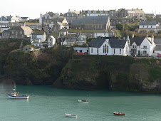
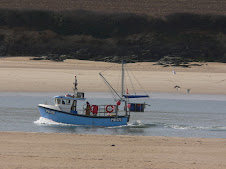
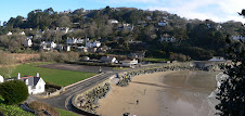
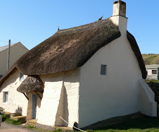
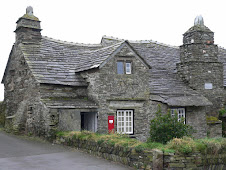
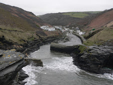
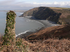
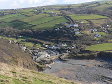
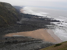
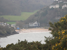
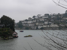
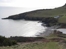
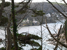
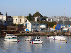
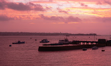
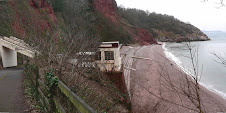
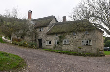
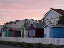
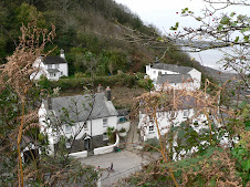
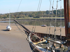
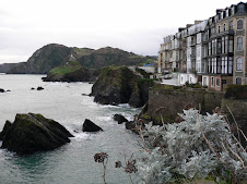
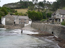
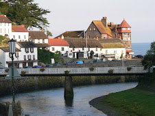
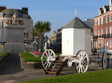
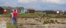
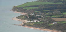
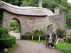
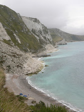
We soon got a good view of Cadgwith Cove from an old Coastguards Watchouse at the head of the bay. It is a very picturesque village with thatched cottages and working fishing boats on the beach.


Cadgwith Cove
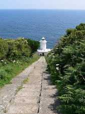
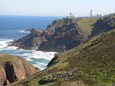
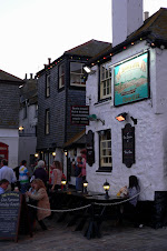
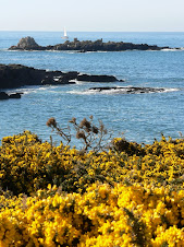
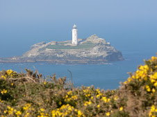
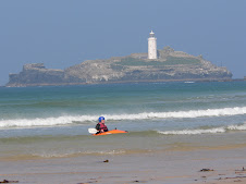
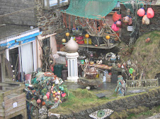
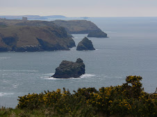
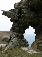
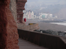
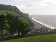
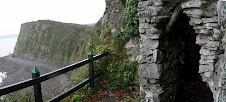
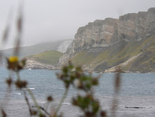
We were ready for another pit stop so stopped for a quick snifter at the Cadgwith Cove Hotel and sat out in the sun watching the bizarre sight of a girl with bright pink hair, tiny tight shorts and fishnet tights who was part of a group on a cycling trip! My attempts to take a sneaky photo ( just for this blog) were thwarted. Leaving Cadgwith, tucking in to Marie's sandwiches - we passed by the unusual collapsed cave known as Devil's Frying Pan with it's bridge shaped inlet and then for the next mile or so, the path was quite open - and we had clear views of the Lighthouse complex at The Lizard.

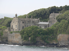
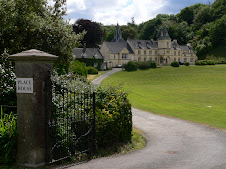
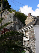
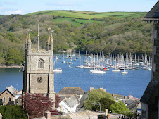
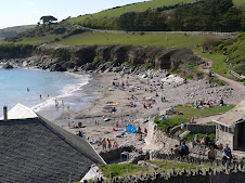
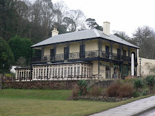
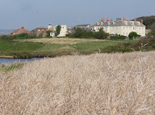
The next point of interest was Church Cove, another former Pilchard Fishery which had been converted into spectacular private dwellings with a superb setting nestled into the cove.
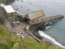
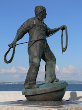
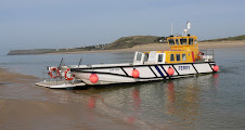
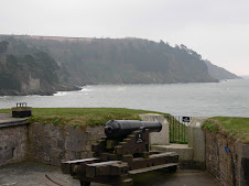
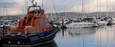
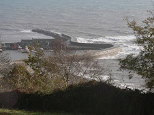
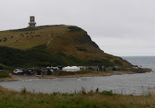
Around the next point was Kilcobben Cove, the dramatic setting of the Lizard Lifeboat with steep rails carrying the lifeboatmen down to the boat in carriages.

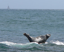
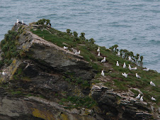
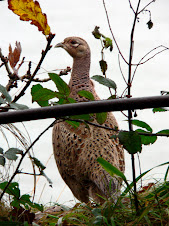
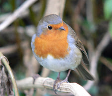
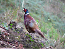
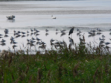
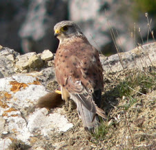
Still no signs of Dolphins or Choughs, although there had been a few false alarms with the odd distant Raven being mistaken. Choughs,are black but have distinctive red beaks and red legs and an unusual high pitched chi-ow call.

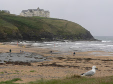
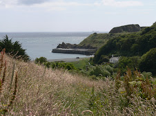
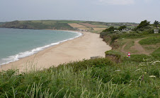
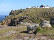
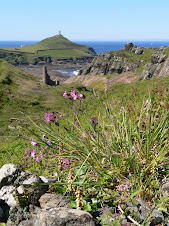
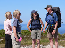
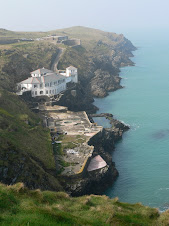
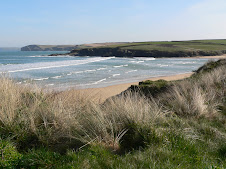
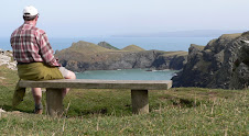
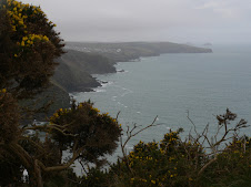
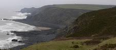
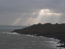
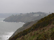
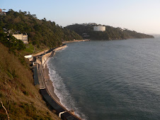
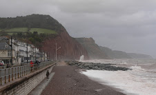
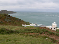
At Bass Point, where there was a large Coastguard station, it didn't look as if we had far to go - Lizard Point being just the other end of the large Housel Bay. Overlooking the bay, was the superbly situated Housel Bay Hotel which looked inviting. As we traversed across a wide open area heading towards the lighthouse complex, Marie suddenly piped up - " look - Chough's" I glanced up, expecting to see just about anything vaguely black with feathers except a Chough, but to my astonishment, 3 black birds with red beaks and legs were flying at high speed across the low cliffs below us. I grabbed my camera, but they were gone in an instant. Well, what could I say, they had made an appearance right on cue - we were only 20 minutes away from the Lizard - now, where were those Dolphins!

The next walkers we bumped into, I excitedly told them about the Choughs, but I probably just sounded like some eccentric twitcher.

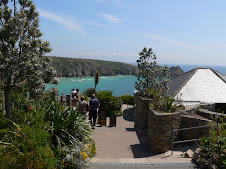
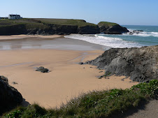
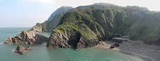
We reached the edge of the lighthouse Complex and then just a bit further on around the corner we got our first glimpse of the rather shabby looking Lizard Point. Disappointingly, there was the distinctive choking smell of raw sewage pervading the area and looking down you could see the sea tinged with brown. I found it unbelievable that they could let that happen in such a landmark area - particularly on such an occasion - ie the grand finish of my walk! I would have liked to have collected a sample in Marie's tupperware sandwich container and posted it 1st class to the Head of Cornish County Council!
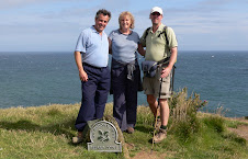
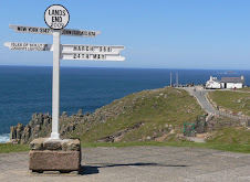
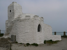
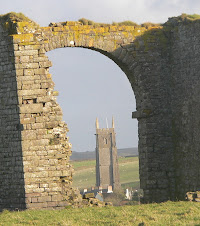
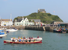
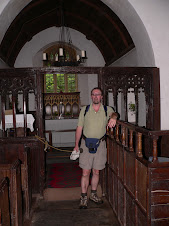
We reached the Point, a collection of small buldings all claiming to be the most Southerly - gift shop, cafe and National Trust office.

The walk was over - 630 miles done and dusted - photos were taken, but I was more interested in getting my laughing gear around another Cream tea. Not even the whiff of human effluent could put us off and we sat in the sun and tucked into Scones, cream and homemade meringue.

It had been a good day's walk, the promised rain never came to anything, and it was good to finish in bright sunshine. Finishing the whole thing was always going to be a bit of an anti-climax, but it was nice to have had some company at the end. All in all, I was quite Choughed!

Final North Walk: Porthleven to The Lizard

Saturday July 18th: Just less than a year after starting this walk at South Haven Point Nr Poole - I now have just about 25 miles left to finish the whole of the SW Coast Path culminating at The Lizard Point.

For my final weekend of walking, on the Saturday, I would be reaching The Lizard from Porthleven and on Sunday, I would reach it from Coverack in the other direction with friends, Jeff and Marie Weeks for the final leg.

I had caught the Friday evening train down to Penzance from Exeter and bussed it to Porthleven, staying in a small B&B called Seefar overlooking the harbour. The weather was forecast to be a bit dodgy - so I didn't hang about and was back on the path just after 8.30am

True to form, it started drizzling before I had left the village with the path leaving the harbour edge past the Clock tower and alongside the seafront cottages out and up to the low cliffs beyond.


Before long I had reached the edge of the massive length of Porthleven Sands which stretched for 2.5 miles all the way to Gunwalloe Fishing Cove. The path carried on above the beach until it reached Loe Pool and Carminowe creek - Cornwall's largest natural lake which edged up to the back of Porthleven Sands. Crossing the sands, it was then a shortish walk up onto the cliffs again to then reach Gunwalloe and then up to the imposing Halzephron Cliffs. A pair of Peregrine Falcons were searching for food, hovering quite close to the cliff edge.


The next point of interest was Church Cove, with the 15th Century Gunwalloe Church nestled into the cliffs above the cove and constantly at risk from erosion. The path passed alongside a golf course before reaching another pleasant cove at Poldhu. Despite the weather - there were several families enjoying the beach and the RNLI lifeguards were in attendance.

Further on, beyond Poldhu Point there was the Marconi Monument, marking the area where the first transatlantic telegraph signals were sent across to America.

The next cove was Polurrian, a small beach resort with cafe and hotel and then at the top of the cliffs beyond an old coastguard Hut, was the large Mullion Cove Hotel looking down onto the small fishing hamlet of Mullion Cove, with Mullion itself, further inland. This small harbour has been battered by the waves over the years, and has belonged to the National Trust since 1945. Its very unspoilt as you would expect and the small cafe looked as if it hadn't changed since the 1940's. Still raining - it was a good time for a pit stop before the last 7 miles to Lizard Point.

Mullion Cove


The coastline was much more rugged now, and would remain so for the rest of the day, it was just a shame that it was so drizzly and misty. There were a series of steep descents and ascents with sheer cliff faces and small caves. At the top of the cliffs was a herd of Long Horn Cattle literally grazing over the cliff edge. Eventually after walking around the Rill Point - the various buldings at the Lizard were clearly visible and in the foreground a series of small islands and rocks which marked the well known Kynance Cove. I could also hear the Lizard - as the Lighthouse was booming out a fog horn at regular intervals. This was my first visit to this area of Cornwall and I was conscious that I wasn't seeing it at it's best. The rocks were the local Serpentine - red and green mottled in appearance interspersed with granite. The cove, also owned by the National Trust sits in a steep valley and is a fantastic setting.

Again, very unspoilt, Kynance Cove consisted of a Cafe, self catering cottages and a toilet complex which was built into the rocks and has a natural roof with flowers. Signs in the toilet, which I graced, described how it was very much a hi-tech Bio-Bubble toilet with all waste being treated and converted into clean water. The roofs of the other buildings had special solar tiles and everything possible had been done to make the whole complex as eco-friendly as possible. I will return on a
better day!
Kynance Cove

The tide was still low, so I was able to take the path at the back of the beach and then climb steeply up to the Kynance Car Park. The views back to the cove and Asparagus Island were superb as I carried on towards the Lizard.
Lizard village itself is a mile or so inland, but the Point was my destination, the most Southerly point of England and the finishing point for my walk. As I approached, it all appeared a bit scruffy. Looking downwards, I could see the remains of an old Lifeboat station and then there was a ramshackle Gift Shop and Cafe which was doing a brisk trade. It was much better inside than out and the home cooked fare looked very tempting. The decision to have a Cream tea took a millisecond and it was superb. I was due to meet my friends Jeff and Marie here - but they were running late - so agreed to catch up with them in the village pub. With some time to kill - I carried on along the path towards the large Lighthouse complex which is also a tourist attraction and then headed inland towards the village. A bit touristy as you might expect, the village was dominated by shops offering Serpentine stone products - mostly in a dark green mottled colour - mostly pretty naff.
I headed for the pub and before long Jeff and Marie turned up, having driven from Exeter. They were keen to join me for my final walk, and it was good to have their company. I had booked a couple of rooms at the Cadgwith Cove Inn which sounded an idyllic location, just a few miles from the Lizard.

Cadgwith was very picturesque and a working fishing village with the boats hauled up the beach by tractor. The Hotel wasn't the best, but it was all about location. Amazingly, Jeff spotted someone he knew walking past the hotel, in this obscure part of Cornwall and they joined us for some drinks.
We then had a great meal - fish was obviously the specialty and it didn't disappoint. Jeff and I were tempted to have a session, but with a 12 mile walk to complete the next day we erred on the cautious side. So, one more day of walking to go - from Coverack back to the Lizard from the other direction - might be tempted to have another Cream tea!

South Walk: Gillan to Coverack

Gillan beach and Creek, nr Helford

Sunday July 12th: Woke up early in the strange surroundings of the caravan at Gillan - it was a beautiful morning after a horrendous night of rain - so before I tucked into breakfast I went for a wander. The estuary was looking very beautiful in the early morning light and I was looking forward to the walk to Coverack, which was only about 11 miles.
Boots were still squelchy wet but at least I had a dry pair of socks!

The path headed out towards Nare Point where there was a large manned coastal observation point. From there, it was a pleasant walk to the small seaside village of Porthallow which has now been recognised as the Official halfway point of the SW Coast path - and an attractive waymark has been erected in it's honour. Apart from that, it didn't have alot to offer. From here, there was a confusing choice of paths according to my guide book - depending on the tide level, so I played safe and stuck to the official path which headed out of the village on the road and took the inland route before dropping down steeply to Porthoustock cove which had some lovely old cottages but was somewhat spoilt by some massive industrial buildings on the beach. This whole stretch of coast has alot of quarry workings, which has meant alot of the path being diverted inland.

From Porthoustock, the path once again headed back inland towards Rosenithon. Apparently, the SW Coastpath Association are pressing for a more coastal route to be established in this area, but the occasional change of scenery is pleasant, especially on such a nice sunny day.

From Rosenthion, it headed back down to the long stony beach at Godrevy Cove and would remain a coastal path all the way to Coverack. The beach is in fact made up from alot of quarry stone waste.
The path proceeded to go straight through the old workings of Dean Quarry which didn't look as if it had been closed all that long. There were old buildings with hard hats and bits and bobs still inside - even if all the windows were smashed. There was quite a nice beach below the quarry, which had it's own Jetty.
Once that Industrial scar was passed, the path became more scenic and natural. It was mostly open low cliff walking from Lowland Point all the way to Coverack. Shortly, I reached an Information board about Lowland Point area being an important nature reserve and there was a lovely picture of 2 seals on the beach. So with seals uppermost in my mind, I found myself gazing at an odd shaped rock just off the coast. As I got nearer, I convinced myself it was a seal - and after zooming in with my camera lens, it was confirmed! The path was actually quite away from the waters edge, so I clambered across the rocks as near to the Seal as possible. It was quite amusing, because the rock was just poking out of the sea and he was perched quite precariously on top. As the sea rose, the seal would arch his body to keep himself from floating off, making him look as if he was actually surfing!
At first he was facing away from me, but I swear that he actually repositioned himself and was keeping a beady eye on me. After taking about 50 photos, I carried on and made sure that I told a few other walkers about it, as it could be easily missed. I said to one man " There's a seal on a rock a little bit further on" "What a real one" he replied!! "Of course it's a real one" ( you stupid man) - what I should have said is, " No it
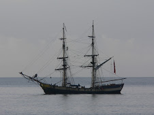
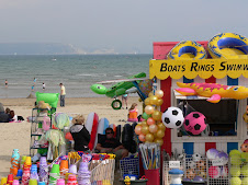
's a 100ft inflatable one, it's part of a new Cornish Disney Theme Park and watch out for the 6ft Remote controlled Dolphins that are leaping all over the place"
Anyway, it was the highlight of the day for me, although I've still yet to see Dolphins on this walk - and only 30 miles to go, so running out of time.
Before long, I reached the outskirts of Coverack and it was a lovely view across the bay to the small harbour at Dolor Point. Coverack is a popular resort with a lovely beach. It heavily promotes the Organic Ice Cream of Roskilly's which is made at a farm nearby in St Keverne. Of more interest, was the oddly named Paris Hotel pub which was offering a Sunday Roast Carvery, which proved impossible to resist, and I still had plenty of time to sample the Ice Cream which didn't seem anything to write a blog about in all honesty.
I had to get a bus back to Helston and then catch another to Truro, where yet again, I was able to enjoy luxury Ist class travel back to Tiverton on my pre booked £10 ticket!
One more weekend of walking left now - just 12 miles from Coverack to the Lizard in one direction and 14 miles from Porthleven to the Lizard in the other direction. My 50th birthday walk was nearing it's end!

Saturday 15 August 2009

South Walk: Falmouth to Gillans Creek, nr Helford

Saturday July 11th: Travelled down to Falmouth Docks by Train, early Saturday morning. Another bargain train ticket bought online - Tiverton Parkway to Truro - FIRST CLASS for just £7!! That was actually cheaper than Second Class! The train from Tiverton was a small shuttle train - but I had to change at Plymouth and then for the first time ever, made my way to the First class carriages to find my large comfy leather seat. In my usual backpacking scruffy attire, I reclined in luxury - the rest of the carriage AND the next carriage completely empty except for little ol' me. Not only that - but I got a complimentary cup of coffee and ginger biscuit thrown in as well. You might have noticed alot of photographs accompanying this Blog for each of my walks. Well, I have to admit to having inadvertently deleted all the photos for this particular days walk - doohhhhh!! Anyway - it was a foul day - got completely soaked and didn't actually take many pictures fortunately.
The plan was to get to Coverack over the weekend, leaving me with just one days walk to my final destination, the Lizard. Helford was my original destination on the Saturday, across the Helford River by ferry from Helford Passage. In fact, I struggled to get accommodation and ended up finding someone who had a 4 berth Caravan available for B&B at a place called Gillan - by a small creek - a few miles further on from Helford.

By the time I reached Falmouth Docks by luxury train, it was starting to rain. The path went past the docks and arround Pendennis Point and along Falmouth promenade towards Swanpool Beach.

It was now raining pretty persistently - so I got my head down and upped the pace. The walking was fairly straightforward mostly along low cliffs, reaching firstly Maenporth and then onto Rosemullion Head. As I approached Helford Passage, I met a serious looking walker coming in the opposite direction. I stopped and had a quick chat - he was doing the SW Coast path, but had also walked all the way from Scotland! I wanted to question him further - but he didn't seem too inclined to stand in the pouring rain and chat, - he was camping along the way - so no surprise if he was in a bad mood.

I eventually reached the Ferry Point - for the short trip across to Helford. The Helford River is one of Cornwall's favourite tourist destinations and is a big sailing area. I wasn't seeing it at it's prime as the weather was so foul. I had passed quite alot of well known gardens along the way as well, such as Trebah and Glendurgan, owned by the NT.

At Helford, I stopped at the old Shipwright's Inn to find it closed! - so I used there undercover outdoor tables to eat my sarnies. There were a German family of 4 travelling on Tandems also sheltering from the rain.

A little further on, I passed a lovely Tea House within an old chapel, so stopped again for a cuppa and to dry out a bit. The path followed the estuary edge towards St Anthony in Meneage at the head of the Helford estuary. Gillan, my destination was just across a small creek around the head. At low tide, you could walk across, but the official SW path went down the creek to Flushing, which was a nice walk despite the weather. I saw a Curlew and various Egrets. From Flushing, the path was a bit cross country and rather vaguely signposted. When I reached Gillan, I was pretty tired and didn't have a clue where this caravan was. However, it's a very small place and as it happens, the first person I saw turned out to be the husband of the lady who I had booked through, and the caravan was in their garden.

It was still sheeting it down and I could see no way that I would get anything dry overnight.
The Caravan was very comfortable and in a secluded area of the garden. The deal was that she supplied an evening meal as well - the nearest pub was Helford. We stood in the pouring rain at the door outside the caravan as she explained that she would bring over a lasagne to the caravan at 7:00pm. That was fine by me - one of my favourites. Soaking wet boots were left under the caravan as I gingerly stepped inside trying not to make a mess. All the stuff for breakfast was laid out - bread rolls, jam etc - plus a nice bit of cake - and the best of all - a large can of lager in the fridge!
Tried to have a shower - but anyone who has caravanned will know what a palaver that is.

The Lasagne arrived - suitably waterproofed - and boy, did that go down well!

The weather proceeded to go from bad to worse as a big storm passed over - but I crashed out fairly early. The next day, I would head for Coverack and the forecast was for a bit of sun - marvellous.

North Walk: Marazion to Porthleven

Sunday June 28th: It was a grey old day with rain forecast later on in the day, which was unexpected - so seeing as I hadn't brought any wet weather gear, I didn't hang about, and left Glenleigh Hotel so quickly that I managed to leave my walking pole in their porch! I would pick it up later on my way back to Penzance on the bus. The path headed out of Marazion on the main road with good views back to St Michaels Mount, before turning off back towards the coast towards Venton Farm and Trenow Cove. This stretch of the path was pretty uninspiring as I headed towards Perran Sands near the old village of Perranuthnoe. Further on the path returns to the clifftop towards Cudden Point and then round to a couple of small coves - one called Prussia Cove and also Bessy's Cove apparently named after Bessy Bussow who ran an infamous alehouse on the cliffs. I headed up a trek and found myself in the courtyard of an impressive old house with a fantastic position overlooking the sea. I was now not far from Praa Sands, a popular holiday spot with a long sandy beach and large campsite. It was a good time to stop for a quick caffeine input and then I walked the length of the beach and rejoined the path to head up back to the cliffs. The clouds had gathered, and the rain soon started - so I got my head down and ploughed on. There were some old mine workings at Trewavas Head and a dramatic cove with sheer cliffs near Tremearne, but apart from that, it was a straightforward and unremarkable walk to then reach Porthleven. I reached it in good time. My pre-booked train from Penzance wasn't until early evening, so I had plenty of time to kill.

Porthleven was a pleasant fishing village with a large harbour. It has a history of boat building including large Clippers and is also well known for some dramatic storm photographs from 1989 when waves were seen crashing over the top of the town Clock Tower. I had a wander round, and then retreated to the bus shelter as the rain came down again. Some entertainment came in the form of a group of youngsters who were hanging about the bus shelter, swearing and smoking - they looked about 12-13yrs old. One of them had a lighter and was fiddling about with it before somehow managing to spray himself with the lighter fluid and setting fire to himself! That was something to swear about - and it shook him up a bit as he flapped about trying to prevent himself becoming a walking inferno. I was ready to spring into action and fan the flames, but he put himself out without injury, apart from his pride of course, as his mates thought it was hilarious.

Porthleven Harbour

Eventually got the bus back to Marazion, picked up my pole, had some lunch and then got another bus back to Penzance.

With time still to kill - I wandered back to penzance harbour where they were still celebrating the Macey Day festival with an outdoor street market and a musical group from South America with wooden pipes and bongo drums and wailing type of vocals, very ethnic. Uneventful journey back to Devon. I was now just one day's walk away from my final destination, The Lizard, on the Minehead ie North direction of the walk!

Sunday 9 August 2009

North Walk - Lands End to Marazion


Saturday June 27th: I travelled down to Penzance on the Friday night from Exeter. I had discovered some really good train ticket deals on this route - £6 each way from Exeter to Penzance - a bargain. Stayed at the Swordfish Inn at Newlyn on Friday night, where there was live music and the pub was pretty packed, but good clean room for the price. Popped into the Chippie next door where there was a massive chap in a Spurs Shirt. "Didn't expect to find a Yiddo in this far corner of Cornwall" I said rather bravely! He could have thought I was a Gooner and shoved a Cod and chips up my bottom, but fortunately we ended up having a good long chat about 'arry and who might come and go pre-season.

The plan on the Saturday was to catch the early bus to Lands End. I thought I might have to leave without the obligatory bacon and Egg breakfast fest, due to the early bus time - but they had a system where you left a breakfast menu card outside your room indicating what you wanted to eat, and when I explained my predicament to the Landlord - he said, just put a note saying what time you want your brekkie - and no problem. That worked - So I was able to catch the excellent no 300 open top bus which circulates in each direction from Lands End - every day during the Season and was at Land End for 9:15am.

As I left the bus - I spotted another walker who was obviously on a mission - and he disppeared in the direction of Penzance from the car park whilst I headed for the Lands End point where I had ended my walk previously. I thought I would catch up with him later

It was a beautiful day which I was glad of, as this stretch of the coast path was going to be one of the most spectacular of the whole path. I had walked part of it before from Minack a few years previously.

There was a group of Cyclists getting prepared for what was no doubt a trip to John O'Groats, but my destination was Penzance, although I was staying at Marazion that night, so legs willing - I might do the extra few miles.

I could see alot of evidence of path erosion at Lands End - due to the popularity and mass tourism, but they had roped off alot of the old paths to allow them to recover. The seascape around Lands End is quite spectacular, if you can ignore the theme park touristy environment around you. There are a series of rocks and small islets and the sea is always in a turmoil. I left the Hotel complex and headed off from Dr Johnson's Head towards Nanjizal bay. The sea was a gorgeous colour and the views just got better and better as I headed in a southerly direction towards Gwennap Head from where I would get my first glimpse of my very final destination - the Lizard! - I would have turned the corner so to speak. For a few miles - I could look back and still see the lands End complex, but after Gwennap Head, it was finally out of view.

At Gwennap - there was a large Coastwatch Station - and I gave the coastguard a friendly wave. It must be a lonely job manning these stations - and many of them are just volunteers, but they do a vital job, not only looking out for ships in trouble - but also logging the likes of myself who might inadvertently go for a nosedive! The rock formations all along this part of the coast were very interesting, with lots of cave formations and strange shaped rocks.
A little further on, I reached a small cove called Porthgwarra where there was a welcome shop. From there the path went up to a high level cliff before dropping down into the beautiful sandy Porthchapel beach. The sea looked quite inviting and it made me think that during all the miles I had walked, I had yet to stop and have a swim! I would be reminded of that later on in the day. From here it was a short hop to the famous Minack Theatre situated at a high vantage point just before Portcurno Beach. The path went right through the Car Park to this popular tourist destination. I had visited Minack before and it has an interesting history for what must be the most spectacular theatre destinations in the country. Built into the rocks within what was a natural amphitheatre, the Theatre was the brainchild of Miss Rowena Cade in the 1930's who helped build it initially for performances to friends and family. The backdrop to the stage is the sea and rocks with Logan Rock looming in the distance. If the weather is kind - it must make for a fantastic evening's entertainment - and there are professional performances all throughout the summer.

Porthcurno Beach

From Minack - it was a very steep climb down to Porthcurno beach where the sea looked Mediterranean in colour. It is one of Cornwall's most beautiful coves and from here it was another 12 miles to Penzance . The path climbed steadily up to the cliff path. I made the diversion out to Logans Rock point from where you got a great view of the Minack Theatre across the bay.

It was at about this point, that I kept meeting running athletes head on. There was obviously some sort of race on, and on the narrow rocky path, it was sometimes difficult to dive out of the way. From then on, they just kept coming all day, men, women - all ages and when I eventually enquired what the race was - a sweaty lady told me that they were running from the Lizard to Lands End!! - just the 45 miles - they had started at 6:00am, the slackers. It is an endurance race that has been staged for the last 3 years apparently - and has raised quite alot of money for charity. I decided that there was no way that I could moan or complain about sore feet at the end of the day - in comparison to that lot of nutters.

A little further on, I reached the small fishing cove of Penberth, where there were several day ramblers having a rest. I headed on and a couple of miles further on, I was stopped by someone who very kindly pointed out that there were some basking sharks clearly visible off Boscawen point. When I reached it - I could see a small boat not far out to see full of people looking at something - but as I made my way closer to the cliff edge, I could clearly see the fins of several sharks swimming quite close to the shore. The cliffs here were tall and steep, so I had a great vantage point looking down on them and with my zoom lens - I could see them with their mouths agape filtering the plankton. they didn't seem as large as I thought - but it was difficult to tell from distance. So that was a first for me, but still no signs of dolphins on this walk! After taking about 50 photos most of which would be no good - I carried on. Someone else told me that there were some basking sharks more close to shore at Lamorna Cove. A little later, as I once again nearly fell into the undergrowth avoiding more runners, I met Sue Robinson. Enjoying the beautiful scenery, Sue, a beauty therapist, had travelled up from Dorset early that morning for a day out and was going to drive to Sennen Cove later on. We walked together for a bit and shared a Cream tea at Lamorna Cove before I headed off for the last stint of the day. Lamorna had a harbour and was previously a busy area for quarrying as you could see from the scarred cliffs. However, there was no sign of any more sharks.

By now - time was going on, so I needed to get a move on. There were still plenty of endurance athletes struggling on. In fact I met one guy laid out by the side of the path under a bush struggling with cramp. I gave him a hand - but he admitted he didn't feel well! Having run 30 miles along a coast path on a hot day, it was hardly surprising. Unfortunately - he had the hardest part of the run still to go.
I was now not far from the tourist hotspot of Mousehole. Suddenly, I rounded a corner and there was the guy who had left the bus at Lands End ahead of me. I stopped and had a chat with him, a retired Geordie, he had been stopping and having a swim at various beaches, which is "what I do" he exclaimed. He was camping at Praa Sands, which was quite a few miles East of Penzance. Obviously quite a fit guy for his age - he admitted that he was ready to stop. I carried on - but then he caught up with me just outside Mousehole and we walked together for a while. By this time, my ankle was giving me quite a bit of jip - so my pace was pretty slow. Geordie boy stopped at Mousehole - he was going to buy a Guardian and have a sit down for awhile! I reckon he would catch the bus from there. Mousehole is a lovely old fishing harbour, mostly a tourist spot now with an interesting history.
Prononuced Mow-zell, it is named after a cave on St Clements isle at the mouth of the harbour where apparently, a hermit once lived. Long ago, Mousehole achieved fame when it was the landing place of the Knights of St John returning back from the Holy Land. From Mousehole - the path followed the road to Newlyn along a new cycle track at the back of the rocky beach.


St Michaels Mount across the other side of the Bay dominated the skyline - and I could see how far I was going to have to walk to Marazion around the edge of Penzance. Newlyn has Cornwall's largest fishing fleets and the massive harbour dominates the place. Apart from a few small shops and the pubs, there is little else to see. I popped back in to the Swordfish for a quick pint as I was passing. From Newlyn, it was a promenade walk all the way to Penzance.

On the train journey up from Exeter, I had listened to some girl students talking about the Mazey Day festival going on in Penzance that weekend. It is the equivalent of Carnival weekend - with colourful parades, street markets and general festivity. As I approached from Newlyn along the road - I could see lots of colourful flags and banners and by this time it was early evening, so people were streeming away from the centre as I came plodding through, having missed the party! There was a large fairground set up and one of the pubs had live music set up outside - so it was all pretty lively.
If I had wanted to catch a bus to Marazion, I would have been out of luck, so although I was struggling a bit - the path to Marazion was level all the way along St Michaels Way - a new waterfront cycle path. The track followed across the back of the long beach which stretched for 2 miles between the outskirts of Penzance and Marazion. St Michaels Mount got larger and larger as I hobbled along. Marazion is thought to be one of Cornwall's oldest settlements with a history of trading in tin - which was smelted on the offshore island of St Michaels Mount. A priory of Benedictine Monks was established on the island in the 11th Century but it eventually became a private residence and is now owned by the National Trust and of course is a big draw for visitors.

You can walk across to the Island along a causeway at low tide. I had visited previously, so gave it a miss this time. I was staying at Glenleigh, where I had been before. It was nearly 8:30pm by the time I arrived. Along the way, I had put my knee bandage on, and the lovely old lady who owned Glendale went into overdrive when she saw me - thinking that I had had some sort of accident - "Oh you poor dear" etc etc. Quick shower and then I made it over to The Fire Engine pub in time. Food was pretty bland and certainly not freshly prepared, but welcome all the same. 22 Miles walked today - one of my longest stints - and one of the most memorable.

Monday 27 July 2009

South Walk: Portloe to Falmouth

Sunday 7th June: Left Portloe with dry boots, straight out of the B&B boiler Room. It was a dry morning but dullish. Destination was Falmouth across both the Percuil River and the Fal Estuary which would involve 2 Ferries at the end of the day.

The first landmark was Nare Head. It was a pleasant walk which included passing a large property known as Broom Parc where the drama "The Camomile Lawn" was filmed. If I remember correctly, it involved scantily clad if not naked ladies cavorting about on their lawn! It was certainly a superb location for such antics and is now an up market B&B owned by the National Trust. As I approached Nare Head, the heavens opened and I got a good soaking, but it soon cleared. However, the views from the Head weren't as good as they could have been. The path descended towards Gerrans Bay and the long stretch of sand of Carne beach. This was dominated by the well positioned Nare Head Hotel - which I had been to before for an over priced Cappuccino, so didn't bother on this occasion. The path passed behind the hotel and on to Pendower Beach where there was also a Hotel. My first coffee stop would be the village of Portscatho which was 3-4 miles further on.

On the way - I met Bruce, who you might guess was Australian! Obviously on a long hike - it turned out he was walking pretty much the whole path in one go on his own. He'd planned it all from Oz - having had a taster of the path on a previous visit and pre booked all the B&B's en route. He was thoroughly enjoying the experience, having thought that he might get bored walking day after day, in fact it was far from the case.

I soon reached Portscatho. This former fishing village is now a small resort. It didn't look all that special on this drizzly Sunday, but the local pub was drumming up business with a special Sunday BBQ in the road which on another occasion, I might have taken advantage of! However - I restricted my intake to a quick pint and cracked on towards the well known landmark, St Anthony's Head at the mouth of the massive inlet known as Carricks Road with Pendennis Point and Falmouth across the other side. The walk was fairly flat across low cliffs as the head loomed ever nearer. I didn't hang about, as I was keen to catch the Ferries reasonably early in order to get back to Truro for my pre-booked train and wasn't sure how much hanging about I would have to do to catch the ferries.

The main vantage point at St Anthony's Head is dominated by the large battery and surrounding old military buildings. The views were far reaching - and the satellite dishes at Goonhilly near my final destination, the Lizard were just about visible. Falmouth loomed across the water.

The path dropped down through some woods to the Lighthouse and then from there it was a lovely walk around the head towards Amsterdam Point and around into a small inlet at a place called Place!

It descended through some more woods until you reached a delightful old Church - St Anthony's of Roseland - and then followed a lane down towards a boat landing point where you suddenly reach the magnificent Place House - an enormous old Manor House with wide lawns which swept down towards the estuary. Formerly a Hotel, it is once again in private ownership.

This was the first Ferry point from where you would be taken to St Mawes. There were two pick up points depending on the tide. A couple of people were messing about on a boat - so as no-one else was there waiting for a ferry - I asked them where it was picking up from. " You need to walk further on" they said "because of the tide" - so I did as I was told and 10 minutes later I watched the Ferry pick up and leave from the boat landing where I had just been! Fortunately the Ferryman saw my predicament and shouted out that he would be back in 10 mins - so I wandered back, and before long there were several of us waiting. It had turned out to be a nice day - and plenty of people were taking advantage of the beautiful location.
It was a quick ride to St Mawes and I literally stepped off one Ferry and straight on to another much larger craft for the longer trip across to Falmouth. It really is a massive estuary. St Mawes looked a pleasant place and had a spectacular Castle dominating the estuary edge.

I was in good time as I reached Falmouth. This was my first visit to one of Cornwall's largest towns and the Docks had obviously had alot of development dominated by the large National Maritime Museum surrounded by a shopping and leisure area. I carried on round the path which would skirt the edge of the Docks, however I quickly reached the Train station at Falmouth Docks - which was the end of the line for the train from Truro. I had an hour to kill before my connection - so wandered on up the hill towards Pendennis Point from where you got a birds eye view of the massive dry docks.
Another few miles under the belt - I would return here in a few weeks to head for Helford.

Sunday 5 July 2009

South Walk: Mevagissey to Portloe

Saturday June 6th: Back down to South Cornwall this weekend - caught the early train to St Austell and hopped on a bus to Mevagissey arriving about 9:30 and just when the rain started! Took the opportunity for some Bacon and Egg and a caffeine injection before hitting the path. Last time I was here - it was a sunny Sunday afternoon and Mike Ricketts and I arrived from Charlestown, and the harbour was packed. On a wet Saturday morning, it was mostly local fisherman who were going about their business.

The path left Mevagissey on the road before heading out towards Chapel Point at the southern end of Mevagissey Bay.
Along the way, on the cliffs I spotted a carcass of what must have been a whale washed up on the rocks. Seagulls were tucking into the masses of blubber which were left - I guess it must have been there awhile.
By now, the rain had stopped - but it was a grey old day - and the coast was pretty unspectacular compared to other parts of Cornwall.

The next destination was Gorran Haven, a small picturesque old fishing village with a nice sandy beach, popular with tourists - but it was deserted today. There was a small church in the narrow streets which proved to be a useful place to change back into wet weather gear as the heavens opened again.

I headed out of Gorran towards Dodman Point - one of the highest landmarks along this stretch of coast - it had a massive stone cross at the top - and for the first time, through the gloom I could just make out The Lizard - my very final destination on this whole escapade.

The path descended steeply down to Hemmick beach - a very secluded spot with just one lovely stone cottage right behind the cove - the perfect idyllic hideaway. Further on, I could see a Castle in the distance. I remembered this from a previous trip to Cornwall - it was Caerhays Castle at Porthluney Cove - and even in the wet looked impressive, especially with a herd of Longhorn Cattle in the grounds!

A couple of miles further on were the old fishing villages of East and West Portholland - 2 coves joined at low tide by a large expanse of sand .

The 2 hamlets are very unspoilt with just a Post Office between them - and most of the residences belong to the Caerhays Castle estate who have maintained the area as a working farm community.

By this time - it was early afternoon - and I was soaking wet. I hadn't booked a B&B as I was unsure whether I would carry on to Portscatho or call it a day at Portloe. Apart from a few expensive hotels - there wasn't much accommodation imbetween.

So when I squelched into Portloe, a few miles further on - I had had enough for the day and started to look around for accommodation. The local pub - The Ship Inn looked inviting - so I woke up the landlord and squelched up to view the room in my soaking wet socks. He was a bit pricey - but kindly recommended another place up the road - there were only 2 B&B's in the place apparently. He had a fantastic massive Ebony elephant in the pub, from Sri Lanka - about 2ft tall - I considered trying to buy it off him!
Successfuly booked into Carradale B&B - nice people - and then wandered back to Portloe harbour - it was a very scenic small harbour dominated by the well known and VERY pricey Lugger Hotel. I felt too underdressed to bother going in for a cup of tea - and anyway - the sun had come out by this time - and there were loads of good photo opportunities.

Apparently, Portloe was where they filmed the rather odd TV programme with Dawn French called Wild West - she was an eccentric inbred shopkeeper if I recall.

The evening was spent at The Ship inn - which was very busy - had to wait quite awhile for a table -but the food was OK. When I got back to the B&B - the owner had put my soaking wet boots in the boiler room to dry out - I crashed out and after a snifter too many - also needed drying out!

Wednesday 24 June 2009

South Walk: Pendeen to Lands End

Sunday May 24th : Breakfast at The Glenleigh Hotel in Marazion provided some amusement. This rather genteel family hotel is rather "old school" so to speak. The, shall we say, mature waitress whose probably been there since 1950 was a little on the deaf side - and unfortunately, so was one of the guests, so one conversation went...
Waitress: " Would you like brown or white toast?"
Deaf Guest: "Tea please"

I made a quick exit - the plan originally had been to try and catch the bus back up to Pendeen, but I would have had to curtail breakfast, so I drove back up there and re-joined the path at Pendeen Watch. It was about 9:30am - and I kept an eye out for Ann and Tara who I had met the day previous, and who were going to walk to Porthcurno from Pendeen. It was a lovely day again, and the sea looked superb. My ankle was really bothering me - so progress was a bit slow and painful.

Almost immediately, I was faced with the siight of a large old mine - Levant, which has been restored. Further inland, is the well known Geevor Tin Mine, which is now a Museum and popular tourist spot. I had visited it previously, and it was a fascinating insight into the Cornish Mining industry. Apparently, the Levant mine had tunnels which went out under the sea for over a mile - and workers could hear the sea crashing above them.

Once past all the mine workings - the next point of interest was Cape Cornwall which soon came into view and was approached through a lovely valley. This landmark is the second most westerly point in England and is a great vantage point. The coast path takes you straight past it - but it is worth the diversion to climb up to the top of the headland where there is an old chimney taken from an old Cornish Mine. Unfortunately it was covered in scaffolding, due to structural problems. At the foot of the headland were some interesting buildings including a Chapel, but at the top, there were fantastic views in both directions and the lighthouse at Lands End was clearly visible

From Cape Cornwall - the views were dominated by Lands End ahead and the various rocky islands off the coast. Most prominent was the Brisons Rocks which have put paid to many a ship in the past. Apparently - the locals refer to the rocks as "Charles de Gaulle lying in the bath" due to nose and stomach shaped rocks. Another series of rocks which were also prominent were Longships with it's tall thin lighthouse sticking up proudly - and it did occur to me, that perhaps the younger generation of locals might be tempted to rename them as "Sylvio Berlusconi in the Bath" !

Soon I was approaching the glorious sands of Whitesand Bay and Sennen. The sea was a beautiful sight rolling into this bay with various breaking points. It was on this stretch of the path that I was accosted by a gentleman who suddenly said " You just missed a Chough singing at you" Well as it happened, I had just heard an unusual bird song - and apparently it had been a Chough. The Chough is known as the Cornwall Chough - but in fact has been mostly absent from Cornwall for many years.

There is an ongoing project to re-introduce it, and there are now two breeding pairs in Cornwall. Black with some iridescent plumage and bright red beak and legs - it should be quite distinctive - so my eyes are now peeled. There is a breeding pair at the Lizard - so hopefully they will sing for me on my arrival!
Sennen Cove at the far end of Whitesand Bay was packed with day trippers enjoying the beach and sea. It's a dangerous place to swim - so lifeguards were out in force - but it's a popular place, rightly so. Briefly, Lands End has disappeared from view as there is the headland of the Irish Lady with it's coatguard lookout imbetween. I ignored the temptaion of the numerous Sennen Cove tea houses and climbed out of Sennen towards the headland and then towards Lands End itself.

Of course, Lands End itself has been touristified for the mass moron market - and Northeners in their thousands descend en masse to stuff a pasty down their throats and have their picture taken at the "First and Last" Gift Shop and visit the Dr Who Adventure centre . Not many will bother to walk very far in either direction - but it is the seascape which is most impressive and the noticeable difference in the sea around the area which seemed to be in constant turmoil.

Lands End was my final destination for the day. It had been a lovely days walk - one which I had done before - but still spectacular.
I was heading for Thurlestone that evening to spend the Bank Holiday Monday with the parents. During the Summer - there is an excellent Bus Service which goes in both directions from Lands End on a circular loop throughout the day - the No 300 - open top as well if you can brave it. You just have to make sure that you get on the right one! Mine was 30 minutes late!

Sunday 31 May 2009

North Walk: St Ives to Pendeen Watch


Porthmear beach, The Tate and St Ives Head

Saturday May 23rd: Only just got the car parked in St Ives - with the added bonus that the ticket machine wasn't working! - left a note in the windscreen just in case. It was going to be a nice day - but started off a bit dull. Made my way back to the harbour and then found the small path around the museum which went out to St Ives Head. St Ives is quite disorientating with it's narrow alleys and back streets - and you often can't see exactly where you are, with no clear view out to the head. At the head, also known as The Island, there is a large grassy area and St Nicholas Chapel sits at the top. The path drops down onto the small beach area of Porthgwidden which had a bulldozer piling all the sand up at the back of the beach for some reason. Next was St Ives main beach , Porthmear with the Tate Gallery just behind. At the end of the beach, the path finally left St Ives for good and slowly climbed up to the cliffs.

The destination for the day was Pendeen Watch - some 13 miles or so under normal circumstances, but there were two large diversions inland due to sections of the path having been washed away. You might recall that 3 people lost their lives recently when their car was caught in a torrent of water after horrendous storms. That tragedy occurred along this stretch of coast and seven footbridges were washed away as a result of the abnormal rainfall, leaving the path inaccessible.

I have walked part of this section before - and it is spectacular, so it was disappointing to have to miss part of it, the only benefit being that the diversion now went right past a rather good pub!

As I left St Ives - I could see several walkers ahead of me - all on a long days walking by the look of them. I seemed to be aching all over and crawled along - it was going to be a long day!

For a while, I followed a couple of ladies and then eventually caught up with them - A mother and daughter, they were on a 3 day walking holiday from St Ives to Penzance and were also headed for Pendeen Watch. We watched a Kestrel quite close to the path who was obviously well used to the stream of walkers passing by. I headed off and said " see you later" as I was sure we would bump into each other again.

It was now bright and sunny, and the sea and sandy coves looked beautiful. It wasn't long before I reached the first path diversion, just before Carn Naun Point and the path headed inland skirting around farmland and then back past Treveal before re-joining the coast path the other side of the point. The Carracks rocky islands were in full view and are sometimes home to Seals. Ahead was Zennor Head after which the path would again be diverted. I very nearly took the wrong path, but there were plenty of other walkers coming in the opposite direction and on a different path to me - so I soon realised my mistake. From the Head - you could glimpse the lighthouse at Pendeen Watch in the distance - it looked a long way!

The path naturally headed inland and then the second diversion took it even further inland into the village of Zennor. The Tinners Arms at Zennor was an ideal lunchtime stop. I was joined by Ann and her daughter, Tara, who I had bumped into earlier and we ended up walking together for the rest of the day. From Cambridge, they were good company and quite obviously keen walkers. On an earlier walking holiday in Cornwall, they had walked from Westward Ho to Padstow which is about 80 miles and only the previous weekend had done a 26 mile sponsored walk!

We left the pub together and headed up the road on the inland diversion. It was reasonably well signposted and mostly though farmers fields. We reached the Gurnard Head Hotel where there was the option to walk down to Gurnard's Head itself, but as the coast path was closed either side of it, we decided to carry on and eventually rejoined the path at Porthmear Cove. The diversion hadn't been as long as we had thought but we had missed a fine part of the coast path.

Glad to be back at the coast we pressed on with Pendeen Watch lighthouse in our sights. We stopped to admire the views at the high vantage point near Bosigran cliffs where the sheer vertical drops to the sea attract alot of rock climbers apparently. We bumped into a Dutch couple of fairly advanced years who were on a weeks walking holiday and heading for Penzance. After a very British conversation about the weather - we left them to their own pace - they were staying at the same B&B as Ann and Tara - so they could compare notes later!

The next few miles were quite difficult walking - very rocky path and interspersed with the odd boggy area. The path was at high level so there were good views in both directions and just before Pendeen we came to Portheras Cove which looked very inviting for a quick dip. It was the first decent bit of sand that we had seen all day since leaving St Ives. Eventually we found ourselves at the car park behind the entrance to the lighthouse. It was built in 1900, as a result of so many ships and lives having been lost on this rugged stretch of coast. The days walk was over - we headed inland to the village of Pendeen itself. Ann and Tara went off to find their B&B and I headed for the bus stop. We would hopefully meet up on the path the next day.
I now had to find myself some accommodation and get back to St Ives for my car. Phoned a couple of places nearby but no luck. Once back at the car and after examining the bus timetables, I came up with a cunning plan to stay the night at Penzance, and then get the early bus back to Pendeen in the morning. The only trouble was - Penzance was FULL. Hoteliers were literally putting up NO VACANCIES signs as I drove past and I found myself crawling along the back streets with several other cars - all of us looking for VACANCIES signs. In the end, I phoned a couple of places in Marazion which is further down the coast near St Michaels Mount. They both said "try the Glenleigh" which turned out to be a lovely old place in the main street which used to be maternity home. It was about 8:15pm by the time I arrived - so I was tired and hungry, but fortunately there was a good pub just across the road within limping distance!


North Walk: Hayle to St Ives

Friday 22nd May: It's May Bank Holiday and I managed to escape from work early to travel down to the St Ives area. On my last visit on the North walk - I ended a weeks walking in a rush to catch a bus at Hayle and managed to miss the proper path into Hayle. I wanted to reach Lands End this weekend, so the plan was to get from Hayle to St Ives tonight - reach Pendeen Watch by the end of Saturday, and then Lands End on Sunday.

Unfortunately, I hadn't got round to finding anywhere to stay, which was a bit daft, being that it was Bank Holiday - but I knew I would find places. A quick phonecall to St Ives TI on the way down was met with some negativity - " St Ives is filling up - it's Bank Holiday" - that's why I'm ringing you, I replied!
Anyway - I found a place in Carbis Bay which is between Hayle and St Ives and on the bus route if needed. By the time I got there it was 5.30pm so I explained that I was going to dash out, get the bus to Hayle and then walk to St Ives. As I was getting ready - her husband knocked on the door and very kindly offered to give me a lift, so that was a good start to the weekend. He was all excited, as he had just bought his neighbours motorboat and was taking it on it's maiden voyage that weekend!
St Ives Bay looking back to Godrevy

Dropped off in Hayle, I had to find my way back to the point in the dunes behind St Ives Bay where I had strayed off the path. The beach here just seems to go on forever and looked particularly beautiful in the late afternoon sun. As you reach the mouth of the estuary, you pass a whole lot of superbly positioned chalets - some of which looked like permanent homes. there is no feery across the estuary here - so you have to walk all the way into Hayle and around the estuary to the small village of Lelant. Hayle was once the site of the largest engineering works in the SouthWest - Harvey's, but it eventually suffered from the decline in mining.
Alot of the walk to Lelant was on the main road and I then had to get across the Golf course to pick up the path along the railway - one of the most scenic rail routes in England. I took a bit of wrong path and ended up popping up right behind a green just as a trio of golfers were chipping onto it. They weren't that impressed - but I eventually was able to ask them the quickest route back to the path.
Carbis Bay was reached and the path passed behind it and then rose up again to the railway and a small footbridge before heading down towards Porthminster. By this time, it was well into Friday night and the various bars and cafe's were full of early bank holiday visitors and after work drinkers. St Ives was just beyond Portminster, I have visited St Ives before - it is another of Cornwall's gems. I wandered further along through the harbour and out to St Ives head. I wanted to end the evening's walk at the far end of St Ives and also find a suitable car park to leave my car the following day.
I found a packed car park at Porthmear beach, but the attendant kindly recommended another one near the Tate - parking is at a premium in St Ives - I would have to be early!

I was ready to get back to the B&B - couldn't find the bus stop - so ended up walking - quite knackered by the time I got back at about 10.00pm - and somehow I had managed to pass all the St Ives watering holes without visiting any of them!

South Walk: Charlestown to Mevagissey

Sunday May 10th: Woke up to a beautiful morning in Charlestown - Michael had slept particularly well having invested in a pair of Ear Plugs as protection against my snoring! Outrageous!

Having arrived to a cloudy and grey Charlestown the previous afternoon, we decided to take advantage of the morning sun to get some photos of the tall ships in the harbour before breakfast. One of the ships had left the harbour and was moored in the Bay and it all made for some scenic pics.

Breakfast was top notch - having joked with the owner the day before, about the cafe which only served ONE scone for their Cream tea - she proceeded to offer us TWO fried Eggs with our Full English breakfast!
We got off smartish - it wasn't going to be a long walk to Mevagissey - but the guide book stressed how strenuous it was!
Firstly we had to go inland due to to cliff falls near Charlestown and then doubled back to the coast path through a new housing estate. It was suprising how much property there was around Charlestown, but the village itself is unspoilt. We walked through an area known as Duporth before reaching the deserted beach of Porthpean. The next landmark was going to be Blacks Head and ahead of us was a succession of ascents and descents through Silvermine Point and the woods at Ropehaven. The views were good in places, but the path was quite overgrown and there was no shortage of stinging nettles! By this point Mike was suffering quite badly from his Hay Fever, and proceeded to sniffle and sneeze all day long like a Mexican Pig farmer. I was sure that smearing some of my Tiger Balm around his nostrils would do the trick, but he was having none of it.

As we approached Blacks Head, I was astonished to see a Deer right on the path ahead of me. Of course, before I could say anything, Mike snuffled along and scared it off into the thick cliff undergrowth. Not sure that he saw it - or even believed that I had seen it!

The next strange animal that we met was Sid the Bear! Sid, complete with plastic raincoat was walking the whole of the SW Coast path in one go with Nifty Nev and raising money for a childrens charity in Birmingham. Nev, who must be knocking on 65-70 proved to be a veteran runner and long distance cyclist who had completed all sorts of marathon trips - but by Doctors orders was now walking with his companion bear, Sid. Following along by road was his wife in their Camper Van - he was quite a character.

We walked out to the headland at Black Head where there were impressive views in both directions. We could just make out Mevagissey in the distance and the long beach at Pentewan was just a mile or two away. Before that was some pleasant walking with plenty more ups and downs. We passed around the point at Drennick before passing through the small cove near Hallane and then onto the village of Pentewan which had the remains of an old working harbour, but was primarily known for it's long and beautiful sandy beach with adjacent holiday chalets. We stopped for a quick pitstop at The Ship Inn. Guess what, Mike got his sandwiches out again - until he spotted a sign stating the bl*****g obvious. The carvery looked tempting, and a Jazz band was setting up in the Beer Garden, but we weren't hanging about and the path left Pentewan on the road out of the village before joining the cliff path and a steep climb up to Penare Point. Before that we had a quick diversion to the remains of Portgiskey, a small cove adjoining Pentewan which once had a fishing community with cellars and a quay all now in ruins.

It wasn't far now to Mevagissey which was bustling with day trippers. Like Polperro, Mevagissey is one of Cornwall's Tourist hotspots but is also still very much a working port and one of Cornwall's main fishing centres. We had a wander around the backstreets, managed to find a pub showing a footie match albeit using some dodgy Esatern European satellite station, and then caught the bus back to St Austell and onto Charlestown. There was an amusing cameo on the bus journey. A couple who had been bickering at the bus stop in Mevagissey asked the driver if he went to Pentewan. "Yes, I do" he says. We all get on and off he goes. As we passed Pentewan and they remained glued to their seats, it did occur to me that perhaps I should query whether they had wanted to get off - but then I thought I would mind my own business. A couple of miles down the road, the amply proportioned and rather fierce looking lady suddenly explodes out of her seat and descends on the hapless driver with hubby trailing sheepishly in her wake. " YOU SAID YOU STOPPED AT PENTEWAN" she bawled. "Well, I do if someone rings the Bell!" was the reply. " I DON'T LIKE BEING LIED TO" shouted Mrs Angry " IF YOU SAY YOU STOP AT PENTEWAN, THEN YOU STOP AT PENTEWAN" "Here in Cornwall, we stops when peoples rings the bell my luvver" Incandescent with rage she and hubby wobbled off the bus in the middle of Nowheresville - it was all going to be Hubby's fault, I could see that, in fact if I was him, I would have jumped back on the bus and done a runner.

Back in Charlestown, there was still time to catch a bit of Chelsea v Arsenal at the Rashleigh Arms and for Mike to sneeze all over everyone before we headed back to Uffculme. A successful weekend - no knee dramas - and when we got back - the F1 highlights from Barcelona was just about to start!

Monday 18 May 2009

South Walk: Fowey to Charlestown

Saturday May 9th: I have been joined by my old mate Michael Ricketts, still in therapy after Barcelona dumped his beloved Chelsea out of the Champions League. We were planning to get to Mevagissey via a stopover in Charlestown. All precautions were taken to prevent any recurrence of the Ricketts F1 knee ( It was the Barcelona Grand Prix on Sunday!) - including a special below the knee strap and tailored itinerary to avoid too many severe gradients. I packed a spare knee joint and my school dissecting kit in case any emergency surgery was required, plus a fold up shotgun if all else failed.

We left bright and early Saturday morning - the plan was to leave the car at Par Rail station, catch the bus to Fowey, walk to Charlestown and then bus it back to Par to pick the car up.
Fowey (pronounced Foy! - you look a bit silly when you ask the bus driver for a single to Fowie, don't you Michael!) is an attractive town on the banks of the River - unspoilt by the working industrial Port and Docks which are further down the River. It exports China Clay - but the estuary was also in the news recently as an example of recessionary times. Apparently - the deep waters of the Fowey estuary are ideal for anchoring large container ships - so the number you see holed up is a reflection on the economy! We walked down to the harbour, passing a couple of cafe's wafting bacon smells - which proved too good to miss, so topped up the calories with Bacon sarnies before getting on our way. Fowey was getting ready for a busy Saturday as part of Daphne du Maurier week - which is a regular annual festival. She once lived at Menabilly Estate, just a couple of miles from Fowey - which was of course Manderley, as featured in the novel Rebecca, and Poldrimouth Cove, nearby also featured.
We walked out of Fowey on the high level esplanade with lovely views across to Polruan and down the estuary. The first point of interest was the strangely named Readymoney Cove with a small beach and welcome toilets! As we climbed back up to the cliff path - we could see the distinctive red and white Gribbin Daymark in the distance at Gribbin Head. Before that we passed through Coombe Haven with it's castle remains and Poldrimouth Bay. It was then a long steep climb up to the waymark - this was the first knee tester of the day, and Michael could test his new innovative knee strap - a below the knee black number much favoured by Hells Angels and Dominatrixes.

The views from Gribbin Head were good in both directions and we could see the Industrial harbour of Par ahead of us. The daymark was built in 1832 as an aid to vessels navigating the headland and is now owned by the National Trust. It only opens between July and September, so I was denied the pleasure of pushing Michael off the top. On the way to Par, I spotted an unusual silk nest of caterpillars much to Mike's disgust. I haven't been able to specifically identify these- but possibly some kind of Moth tent caterpillar - certainly unusual. In the excitement of this zoological find and in attempting to get a close up pic - I must have dropped my Map and coast path guide, because after passing through the quaint village and cove of Polkerris, I discovered I had lost them. That's the second map I have lost in 500 miles - particular annoying as it is a specialist coastal path map which I had sent away for. I blamed Ricketts.

Polkerris had a tempting Pub and nice beach cafe - but we carried onto Polmear at the start of Par Sands. We met another intrepid path walker who gave us a clue to where the path went - as it seemd rather confusing. In fact we still got a bit lost trying to find our way into Par itself as it is dominated by a large China Clay plant which you have to walk around. Not the most scenic of places, in fact for Cornwall, you could say that it was well below Par on the scenic front! With the guidance of another local - we eventually found ourselves passing the Welcome Inn - which was indeed welcoming! - in fact the landlady proceeded to give me a pint of lager before we had even asked for anything! I got her to put a top in it, meanwhile one of the locals had his head in his hands at the bar. She had given me his pint - and a few minutes later came out to apologise profusely and brought me a fresh pint - all much to the locals amusement. Mike proceeded to get his sandwiches out much to my discomfort - you can stretch peoples hospitality a little too far!

It was another 4-5 miles to Charlestown - and was quite cold by now. The path went alongside Par Golf course and then behind Carlyon Bay which is now the site of a massive redevlopment project called "The Beach" Once a well known resort and popular nightspot, it has been acquired by Developers Ampersand - who plan to turn it into a sustainable tourist resort with over 500 holiday homes and the usual facilities, although there has been a backlash from the locals who see it as ruining an area of natural beauty. At present it is just an eyesore.

We could now get see the large town of St Austell ahead of us - Cornwall's most populated town, which was just inland from our destination, Charlestown which was soon reached. I didn't know much about Charlestown, but it is a small village with an unspoilt port owned by The Square Sail Shipping Company and home to an impressive display of historic ships. It has a history of being used as a film location including the Onedin Line of course, Poldark and The Three Musketeers.

Meanwhile, the 2 Musketeers were more interested in finding somewehere to stuff ourselves with a Cornish Cream tea. We settled ourselves down in a very smart looking establishment, only to find that they only offered ONE scone with their cream tea and at £4.95 they were certainly taking the "Michael Ricketts" We stormed out in disgust and went to the more genteel hotel on the harbour front where normality was resumed and we proceeded to struggle to eat 2 scones!

I caught the bus back to Par to get the car and on my return we booked in at the B&B which was pleasant enough despite being festooned with Bolton FC memorabilia. the evening pub crawl of Charlestown didn't take long - there was only 2 - but they both had pool tables and Sky Sports! - our kinda place - it turned out that people travelled out from St Austell to watch the footie. The day got even better when I thrashed Mike on the Pool Table - some things never change. Tomorrow we would head for Mevagissey.