Sunday, 31 May 2009

North Walk: St Ives to Pendeen Watch


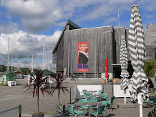
Porthmear beach, The Tate and St Ives Head

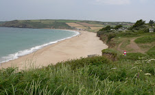
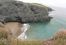
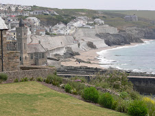
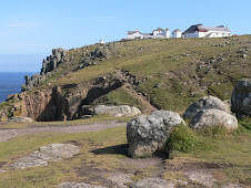
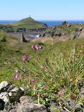
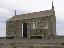
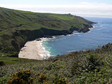
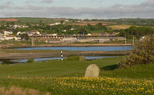
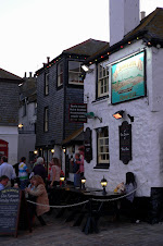
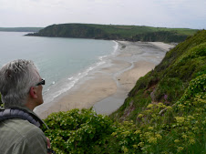
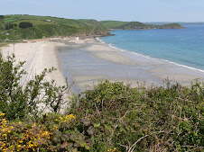
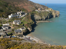
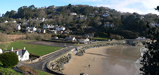
Saturday May 23rd: Only just got the car parked in St Ives - with the added bonus that the ticket machine wasn't working! - left a note in the windscreen just in case. It was going to be a nice day - but started off a bit dull. Made my way back to the harbour and then found the small path around the museum which went out to St Ives Head. St Ives is quite disorientating with it's narrow alleys and back streets - and you often can't see exactly where you are, with no clear view out to the head. At the head, also known as The Island, there is a large grassy area and St Nicholas Chapel sits at the top. The path drops down onto the small beach area of Porthgwidden which had a bulldozer piling all the sand up at the back of the beach for some reason. Next was St Ives main beach , Porthmear with the Tate Gallery just behind. At the end of the beach, the path finally left St Ives for good and slowly climbed up to the cliffs.

The destination for the day was Pendeen Watch - some 13 miles or so under normal circumstances, but there were two large diversions inland due to sections of the path having been washed away. You might recall that 3 people lost their lives recently when their car was caught in a torrent of water after horrendous storms. That tragedy occurred along this stretch of coast and seven footbridges were washed away as a result of the abnormal rainfall, leaving the path inaccessible.

I have walked part of this section before - and it is spectacular, so it was disappointing to have to miss part of it, the only benefit being that the diversion now went right past a rather good pub!

As I left St Ives - I could see several walkers ahead of me - all on a long days walking by the look of them. I seemed to be aching all over and crawled along - it was going to be a long day!

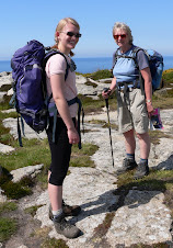
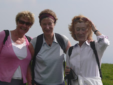
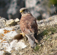
For a while, I followed a couple of ladies and then eventually caught up with them - A mother and daughter, they were on a 3 day walking holiday from St Ives to Penzance and were also headed for Pendeen Watch. We watched a Kestrel quite close to the path who was obviously well used to the stream of walkers passing by. I headed off and said " see you later" as I was sure we would bump into each other again.

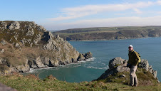
It was now bright and sunny, and the sea and sandy coves looked beautiful. It wasn't long before I reached the first path diversion, just before Carn Naun Point and the path headed inland skirting around farmland and then back past Treveal before re-joining the coast path the other side of the point. The Carracks rocky islands were in full view and are sometimes home to Seals. Ahead was Zennor Head after which the path would again be diverted. I very nearly took the wrong path, but there were plenty of other walkers coming in the opposite direction and on a different path to me - so I soon realised my mistake. From the Head - you could glimpse the lighthouse at Pendeen Watch in the distance - it looked a long way!

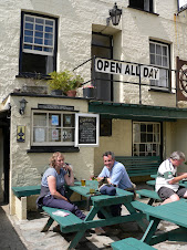
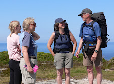
The path naturally headed inland and then the second diversion took it even further inland into the village of Zennor. The Tinners Arms at Zennor was an ideal lunchtime stop. I was joined by Ann and her daughter, Tara, who I had bumped into earlier and we ended up walking together for the rest of the day. From Cambridge, they were good company and quite obviously keen walkers. On an earlier walking holiday in Cornwall, they had walked from Westward Ho to Padstow which is about 80 miles and only the previous weekend had done a 26 mile sponsored walk!

We left the pub together and headed up the road on the inland diversion. It was reasonably well signposted and mostly though farmers fields. We reached the Gurnard Head Hotel where there was the option to walk down to Gurnard's Head itself, but as the coast path was closed either side of it, we decided to carry on and eventually rejoined the path at Porthmear Cove. The diversion hadn't been as long as we had thought but we had missed a fine part of the coast path.

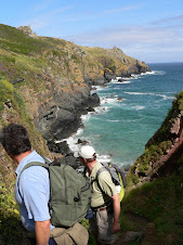
Glad to be back at the coast we pressed on with Pendeen Watch lighthouse in our sights. We stopped to admire the views at the high vantage point near Bosigran cliffs where the sheer vertical drops to the sea attract alot of rock climbers apparently. We bumped into a Dutch couple of fairly advanced years who were on a weeks walking holiday and heading for Penzance. After a very British conversation about the weather - we left them to their own pace - they were staying at the same B&B as Ann and Tara - so they could compare notes later!

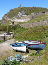
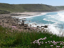
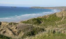
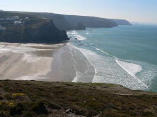
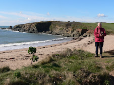
The next few miles were quite difficult walking - very rocky path and interspersed with the odd boggy area. The path was at high level so there were good views in both directions and just before Pendeen we came to Portheras Cove which looked very inviting for a quick dip. It was the first decent bit of sand that we had seen all day since leaving St Ives. Eventually we found ourselves at the car park behind the entrance to the lighthouse. It was built in 1900, as a result of so many ships and lives having been lost on this rugged stretch of coast. The days walk was over - we headed inland to the village of Pendeen itself. Ann and Tara went off to find their B&B and I headed for the bus stop. We would hopefully meet up on the path the next day.
I now had to find myself some accommodation and get back to St Ives for my car. Phoned a couple of places nearby but no luck. Once back at the car and after examining the bus timetables, I came up with a cunning plan to stay the night at Penzance, and then get the early bus back to Pendeen in the morning. The only trouble was - Penzance was FULL. Hoteliers were literally putting up NO VACANCIES signs as I drove past and I found myself crawling along the back streets with several other cars - all of us looking for VACANCIES signs. In the end, I phoned a couple of places in Marazion which is further down the coast near St Michaels Mount. They both said "try the Glenleigh" which turned out to be a lovely old place in the main street which used to be maternity home. It was about 8:15pm by the time I arrived - so I was tired and hungry, but fortunately there was a good pub just across the road within limping distance!


North Walk: Hayle to St Ives

Friday 22nd May: It's May Bank Holiday and I managed to escape from work early to travel down to the St Ives area. On my last visit on the North walk - I ended a weeks walking in a rush to catch a bus at Hayle and managed to miss the proper path into Hayle. I wanted to reach Lands End this weekend, so the plan was to get from Hayle to St Ives tonight - reach Pendeen Watch by the end of Saturday, and then Lands End on Sunday.

Unfortunately, I hadn't got round to finding anywhere to stay, which was a bit daft, being that it was Bank Holiday - but I knew I would find places. A quick phonecall to St Ives TI on the way down was met with some negativity - " St Ives is filling up - it's Bank Holiday" - that's why I'm ringing you, I replied!
Anyway - I found a place in Carbis Bay which is between Hayle and St Ives and on the bus route if needed. By the time I got there it was 5.30pm so I explained that I was going to dash out, get the bus to Hayle and then walk to St Ives. As I was getting ready - her husband knocked on the door and very kindly offered to give me a lift, so that was a good start to the weekend. He was all excited, as he had just bought his neighbours motorboat and was taking it on it's maiden voyage that weekend!
St Ives Bay looking back to Godrevy

Dropped off in Hayle, I had to find my way back to the point in the dunes behind St Ives Bay where I had strayed off the path. The beach here just seems to go on forever and looked particularly beautiful in the late afternoon sun. As you reach the mouth of the estuary, you pass a whole lot of superbly positioned chalets - some of which looked like permanent homes. there is no feery across the estuary here - so you have to walk all the way into Hayle and around the estuary to the small village of Lelant. Hayle was once the site of the largest engineering works in the SouthWest - Harvey's, but it eventually suffered from the decline in mining.
Alot of the walk to Lelant was on the main road and I then had to get across the Golf course to pick up the path along the railway - one of the most scenic rail routes in England. I took a bit of wrong path and ended up popping up right behind a green just as a trio of golfers were chipping onto it. They weren't that impressed - but I eventually was able to ask them the quickest route back to the path.
Carbis Bay was reached and the path passed behind it and then rose up again to the railway and a small footbridge before heading down towards Porthminster. By this time, it was well into Friday night and the various bars and cafe's were full of early bank holiday visitors and after work drinkers. St Ives was just beyond Portminster, I have visited St Ives before - it is another of Cornwall's gems. I wandered further along through the harbour and out to St Ives head. I wanted to end the evening's walk at the far end of St Ives and also find a suitable car park to leave my car the following day.
I found a packed car park at Porthmear beach, but the attendant kindly recommended another one near the Tate - parking is at a premium in St Ives - I would have to be early!

I was ready to get back to the B&B - couldn't find the bus stop - so ended up walking - quite knackered by the time I got back at about 10.00pm - and somehow I had managed to pass all the St Ives watering holes without visiting any of them!

South Walk: Charlestown to Mevagissey

Sunday May 10th: Woke up to a beautiful morning in Charlestown - Michael had slept particularly well having invested in a pair of Ear Plugs as protection against my snoring! Outrageous!

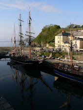
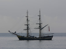
Having arrived to a cloudy and grey Charlestown the previous afternoon, we decided to take advantage of the morning sun to get some photos of the tall ships in the harbour before breakfast. One of the ships had left the harbour and was moored in the Bay and it all made for some scenic pics.

Breakfast was top notch - having joked with the owner the day before, about the cafe which only served ONE scone for their Cream tea - she proceeded to offer us TWO fried Eggs with our Full English breakfast!
We got off smartish - it wasn't going to be a long walk to Mevagissey - but the guide book stressed how strenuous it was!
Firstly we had to go inland due to to cliff falls near Charlestown and then doubled back to the coast path through a new housing estate. It was suprising how much property there was around Charlestown, but the village itself is unspoilt. We walked through an area known as Duporth before reaching the deserted beach of Porthpean. The next landmark was going to be Blacks Head and ahead of us was a succession of ascents and descents through Silvermine Point and the woods at Ropehaven. The views were good in places, but the path was quite overgrown and there was no shortage of stinging nettles! By this point Mike was suffering quite badly from his Hay Fever, and proceeded to sniffle and sneeze all day long like a Mexican Pig farmer. I was sure that smearing some of my Tiger Balm around his nostrils would do the trick, but he was having none of it.

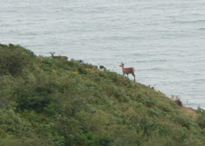
As we approached Blacks Head, I was astonished to see a Deer right on the path ahead of me. Of course, before I could say anything, Mike snuffled along and scared it off into the thick cliff undergrowth. Not sure that he saw it - or even believed that I had seen it!

The next strange animal that we met was Sid the Bear! Sid, complete with plastic raincoat was walking the whole of the SW Coast path in one go with Nifty Nev and raising money for a childrens charity in Birmingham. Nev, who must be knocking on 65-70 proved to be a veteran runner and long distance cyclist who had completed all sorts of marathon trips - but by Doctors orders was now walking with his companion bear, Sid. Following along by road was his wife in their Camper Van - he was quite a character.

We walked out to the headland at Black Head where there were impressive views in both directions. We could just make out Mevagissey in the distance and the long beach at Pentewan was just a mile or two away. Before that was some pleasant walking with plenty more ups and downs. We passed around the point at Drennick before passing through the small cove near Hallane and then onto the village of Pentewan which had the remains of an old working harbour, but was primarily known for it's long and beautiful sandy beach with adjacent holiday chalets. We stopped for a quick pitstop at The Ship Inn. Guess what, Mike got his sandwiches out again - until he spotted a sign stating the bl*****g obvious. The carvery looked tempting, and a Jazz band was setting up in the Beer Garden, but we weren't hanging about and the path left Pentewan on the road out of the village before joining the cliff path and a steep climb up to Penare Point. Before that we had a quick diversion to the remains of Portgiskey, a small cove adjoining Pentewan which once had a fishing community with cellars and a quay all now in ruins.

It wasn't far now to Mevagissey which was bustling with day trippers. Like Polperro, Mevagissey is one of Cornwall's Tourist hotspots but is also still very much a working port and one of Cornwall's main fishing centres. We had a wander around the backstreets, managed to find a pub showing a footie match albeit using some dodgy Esatern European satellite station, and then caught the bus back to St Austell and onto Charlestown. There was an amusing cameo on the bus journey. A couple who had been bickering at the bus stop in Mevagissey asked the driver if he went to Pentewan. "Yes, I do" he says. We all get on and off he goes. As we passed Pentewan and they remained glued to their seats, it did occur to me that perhaps I should query whether they had wanted to get off - but then I thought I would mind my own business. A couple of miles down the road, the amply proportioned and rather fierce looking lady suddenly explodes out of her seat and descends on the hapless driver with hubby trailing sheepishly in her wake. " YOU SAID YOU STOPPED AT PENTEWAN" she bawled. "Well, I do if someone rings the Bell!" was the reply. " I DON'T LIKE BEING LIED TO" shouted Mrs Angry " IF YOU SAY YOU STOP AT PENTEWAN, THEN YOU STOP AT PENTEWAN" "Here in Cornwall, we stops when peoples rings the bell my luvver" Incandescent with rage she and hubby wobbled off the bus in the middle of Nowheresville - it was all going to be Hubby's fault, I could see that, in fact if I was him, I would have jumped back on the bus and done a runner.

Back in Charlestown, there was still time to catch a bit of Chelsea v Arsenal at the Rashleigh Arms and for Mike to sneeze all over everyone before we headed back to Uffculme. A successful weekend - no knee dramas - and when we got back - the F1 highlights from Barcelona was just about to start!

Monday, 18 May 2009

South Walk: Fowey to Charlestown

Saturday May 9th: I have been joined by my old mate Michael Ricketts, still in therapy after Barcelona dumped his beloved Chelsea out of the Champions League. We were planning to get to Mevagissey via a stopover in Charlestown. All precautions were taken to prevent any recurrence of the Ricketts F1 knee ( It was the Barcelona Grand Prix on Sunday!) - including a special below the knee strap and tailored itinerary to avoid too many severe gradients. I packed a spare knee joint and my school dissecting kit in case any emergency surgery was required, plus a fold up shotgun if all else failed.

We left bright and early Saturday morning - the plan was to leave the car at Par Rail station, catch the bus to Fowey, walk to Charlestown and then bus it back to Par to pick the car up.
Fowey (pronounced Foy! - you look a bit silly when you ask the bus driver for a single to Fowie, don't you Michael!) is an attractive town on the banks of the River - unspoilt by the working industrial Port and Docks which are further down the River. It exports China Clay - but the estuary was also in the news recently as an example of recessionary times. Apparently - the deep waters of the Fowey estuary are ideal for anchoring large container ships - so the number you see holed up is a reflection on the economy! We walked down to the harbour, passing a couple of cafe's wafting bacon smells - which proved too good to miss, so topped up the calories with Bacon sarnies before getting on our way. Fowey was getting ready for a busy Saturday as part of Daphne du Maurier week - which is a regular annual festival. She once lived at Menabilly Estate, just a couple of miles from Fowey - which was of course Manderley, as featured in the novel Rebecca, and Poldrimouth Cove, nearby also featured.
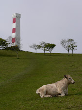
We walked out of Fowey on the high level esplanade with lovely views across to Polruan and down the estuary. The first point of interest was the strangely named Readymoney Cove with a small beach and welcome toilets! As we climbed back up to the cliff path - we could see the distinctive red and white Gribbin Daymark in the distance at Gribbin Head. Before that we passed through Coombe Haven with it's castle remains and Poldrimouth Bay. It was then a long steep climb up to the waymark - this was the first knee tester of the day, and Michael could test his new innovative knee strap - a below the knee black number much favoured by Hells Angels and Dominatrixes.

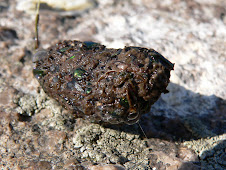
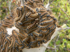
The views from Gribbin Head were good in both directions and we could see the Industrial harbour of Par ahead of us. The daymark was built in 1832 as an aid to vessels navigating the headland and is now owned by the National Trust. It only opens between July and September, so I was denied the pleasure of pushing Michael off the top. On the way to Par, I spotted an unusual silk nest of caterpillars much to Mike's disgust. I haven't been able to specifically identify these- but possibly some kind of Moth tent caterpillar - certainly unusual. In the excitement of this zoological find and in attempting to get a close up pic - I must have dropped my Map and coast path guide, because after passing through the quaint village and cove of Polkerris, I discovered I had lost them. That's the second map I have lost in 500 miles - particular annoying as it is a specialist coastal path map which I had sent away for. I blamed Ricketts.

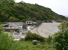
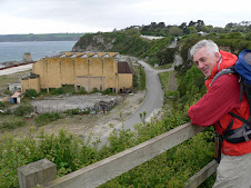
Polkerris had a tempting Pub and nice beach cafe - but we carried onto Polmear at the start of Par Sands. We met another intrepid path walker who gave us a clue to where the path went - as it seemd rather confusing. In fact we still got a bit lost trying to find our way into Par itself as it is dominated by a large China Clay plant which you have to walk around. Not the most scenic of places, in fact for Cornwall, you could say that it was well below Par on the scenic front! With the guidance of another local - we eventually found ourselves passing the Welcome Inn - which was indeed welcoming! - in fact the landlady proceeded to give me a pint of lager before we had even asked for anything! I got her to put a top in it, meanwhile one of the locals had his head in his hands at the bar. She had given me his pint - and a few minutes later came out to apologise profusely and brought me a fresh pint - all much to the locals amusement. Mike proceeded to get his sandwiches out much to my discomfort - you can stretch peoples hospitality a little too far!

It was another 4-5 miles to Charlestown - and was quite cold by now. The path went alongside Par Golf course and then behind Carlyon Bay which is now the site of a massive redevlopment project called "The Beach" Once a well known resort and popular nightspot, it has been acquired by Developers Ampersand - who plan to turn it into a sustainable tourist resort with over 500 holiday homes and the usual facilities, although there has been a backlash from the locals who see it as ruining an area of natural beauty. At present it is just an eyesore.

We could now get see the large town of St Austell ahead of us - Cornwall's most populated town, which was just inland from our destination, Charlestown which was soon reached. I didn't know much about Charlestown, but it is a small village with an unspoilt port owned by The Square Sail Shipping Company and home to an impressive display of historic ships. It has a history of being used as a film location including the Onedin Line of course, Poldark and The Three Musketeers.

Meanwhile, the 2 Musketeers were more interested in finding somewehere to stuff ourselves with a Cornish Cream tea. We settled ourselves down in a very smart looking establishment, only to find that they only offered ONE scone with their cream tea and at £4.95 they were certainly taking the "Michael Ricketts" We stormed out in disgust and went to the more genteel hotel on the harbour front where normality was resumed and we proceeded to struggle to eat 2 scones!

I caught the bus back to Par to get the car and on my return we booked in at the B&B which was pleasant enough despite being festooned with Bolton FC memorabilia. the evening pub crawl of Charlestown didn't take long - there was only 2 - but they both had pool tables and Sky Sports! - our kinda place - it turned out that people travelled out from St Austell to watch the footie. The day got even better when I thrashed Mike on the Pool Table - some things never change. Tomorrow we would head for Mevagissey.

Sunday, 17 May 2009

South Walk: Looe to Fowey

Sunday May 3rd: Woke up to a beautiful morning in Looe - so had a nice early morning pre breakfast stroll along the River. The light was beautiful, but the tide was out so it wasn't quite as scenic as it could have been. The B&B was pretty full, but then it was the May Bank Holiday. The destination for the day was either Par or Fowey and then I would get the train back to Tiverton from the main line station at Par. But the first target was the beautiful and popular village of Polperro - a real tourist hotspot. Only 5 miles from Looe and with a bus service between the two - the path was a popular and well trodden route for the tourists.

Leaving West Looe past Hannafore Point, I got a good view of Looe Island. It used to be owned by two sisters, Evelyn and Babs Atkins, but since their deaths, in 1997 and 2004 respectively, the Island has been owned by the Cornish Wildlife Trust, and you can visit by boat trip.

Passing the small bay of Portnadler - it was a very pleasant few miles to Talland Bay. There were plenty of people on the path. At one point, I passed 2 heavyweight couples, the two women struggling to make headway in nothing but slip-ons - well that's not strictly true - fortunately they did have clothes on - but no socks - their husbands were saying " only 3 miles to Polperro" Madness!

Beyond Talland Bay - I met a woman asking if I had seen a Beagle! She was worried that it would be piling into the Cafe at Talland, have a Cappuccino and dog biscuit and then leaving without paying!

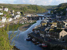
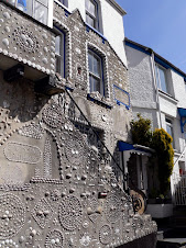
Approaching Polperro, I met a massive group of about 15 ramblers all heading for Looe - it was getting a bit like Piccadilly Circus! The views of Polperro as you approached were lovely and the sailing boat in moored just outside the harbour made it even more photogenic. The path winds through the narrow streets by the harbour towards the bridge passing the well known Shell House. I stocked up on liquid refreshment and homemade fudge before carrying on out of the village by the old well known pub the Blue Peter which stands right at the mouth of the harbour.

As you climb steeply out of the small bay - you get another great view of this wonderfully unspoilt fishing village. I was pleased that it was early May, as opposed to the middle of August when I expect the place is pretty unbearable! although I'm sure the local tourist businesses don't complain.

It was another 7 miles to Fowey and according to the Guide Book - it was the second hardest stretch of the whole Coast Path. In fact, I had met another coast path walker earlier that morning who had said it was pretty tough - with a succession of steps that seemed to go on and on for ever. he was one of many South West Coast path walkers who I have met - doing the path over 6 years or so - and spending a week at a time doing a particular stretch.

As it turned out - the steps didn't seem to be as bad as I had expected and I came to the conclusion that they were probably worse going in the opposite direction. Having said that - after nearly 500 miles of the path already walked - I think I am ready for anything the path has to chuck at me!

For a while - I walked with a local man- out exercising his sheep dog - as we walked towards Pencarrow Head . He seemed quite bemused about my walk - but I thought he must have met loads of people doing similar. All the locals I saw were wearing rainwear - even though it was lovely and sunny - but apparently in this part of the South West - it virtually rains every day - so they know to expect it.

Approaching Pencarrow Head , there seemed to be some confusion about alternative routes, but the obvious one was to climb up to the rocky headland where the views were superb. From here it was a nice walk down and behind the popular beach of Great Lantic Bay. There was a couple more up and down stretches before Polruan was in sight and the mouth of the Fowey river. The path went right past the very small Coastwatch lookout and to the head of the estuary with views across to Fowey. It was then a straightforward path down to the quayside at Polruan where along with several other walkers, I waited for the Ferry across to Fowey. It was a quick trip over, and a chance to view Polruan from the water, it reminded me of Kingswear across from Dartmouth. The Ferry stopped at next to a small beach at a lower point than normal due to the tide. It was still reasonably early, so I could have pressed on to Par, but made the fatal error of going for a cup of tea and ending up with the full Cornish Cream Tea at the splendid Fowey Hotel which had commanding views across the Estuary. I made a mess up of my bus connections - had to wait 50 minutes at Fowey - missed one while scoffing scones! - then at Par station missed a train by 5 minutes and had to wait another 45 minutes - so in hindsight, I should have just carried on walking - but my feet were telling me otherwise!

It was an uneventful train journey back to Tiverton Parkway, by which time I was suitably refreshed to walk on home. Next week it's back to Fowey with walking legend Michael Ricketts!


South Walk: Portwrinkle to Looe

Saturday 2nd May: May Bank Holiday and I'm off back to Portwrinkle. After much consultation with Bus Timetables, I decided to leave the car at home and make do with Public Transport.

Firstly, I had to get to the train station - get the bike out, I thought, dust it down, blow up the tyres. Well, I should have blown up the bike itself - b****y thing, tyre went down half way to the station, fortunately because it's not the first time, I left myself plenty of time to finish the journey on foot, but arrived hot and bothered - not a good start to the day.

Took the train to Plymouth and then a bus across on the Torpoint ferry ( that was a first!) and then eventually, after a 45 mnute wait and a quick bacon sarnie, another bus to Crafthole from where I could wander down to re-join the path at Portwrinkle. Despite leaving Devon in full sunshine - South Cornwall was awash in sea mist, and it didn't clear until lunchtime, which was a shame as the first part of the walk across the cliffs to Downderry was supposed to be very scenic and exhilarating even. Further on, I reached another Seaton - much smaller than it's East Devon cousin, a small sandy bay adjoining a local Nature Reserve. From here, the path heads steeply up a lane heading towards the famous Woolly Monkey Sanctuary, first established in 1964. But there was to be no monkey business for me, and the path soon diverted back through some woods heading towards Bodigga Cliff, a popular tourist spot with easy access.
A little further on, and I dropped down into the deserted holiday beach of Millendreath which used to be a Holiday village, but is now a sad concrete mess together with a massive disused warehouse cum sports Hall - it was a real blot on the path.
I headed on, my destination was Looe, although depending on the time and state of my legs, I thought I might carry on to Polperro.As I neared Looe, I kept seeing power boats whizzing about, and it turned out that it was a special competition day based in Looe which added some extra interest for the Bank holiday.
I couldn't remember having visited Looe, but recognised it when I saw it, being separated by a bridge across the river into East and West Looe. I hadn't booked any accommodation, but the gentleman at the TI office was most helpful and I ended up finding a small B&B on the road out of West Looe near Hannafore. I thought afterwards, that I could have headed on to Polperro, but decided to spend a bit of time in Looe instead. For some reason, I had felt tired out all day, but I hadn't walked all that far. Looe has quite a bit of character and a scenic harbour with plenty of bird life up the River.
I didn't have to walk far for a meal out, the pub right near the B&B turned out to be an excellent choice - Tom Sawyer's Tavern gets my recommendation. The next day I would head for Fowey.

South Walk: Cremyll to Portwrinkle

Sunday 12th April: It was another beautiful morning in Cremyll, where I was staying at the Edgcumbe Arms. After the usual Bacon and Egg energy boost, I started on the path for the walk to Portwrinkle -which was about 13 miles away. The pub was literally on the path, being right next to the Ferry Point which was also a Bus stop, so it was ideal and I would get the bus back later that afternoon.

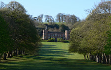
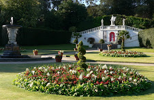
The path immediately entered the Mount Edgcumbe Country Park with superb views of the main house at the top of a tree lined grassy hill. It then went through the Orangery set in beautiful gardens at their best in the early morning sun, and then an ornamental lake, before eventually entering a woodland and meandered at high level with views across the Sound. The woodland area and gardens seemed a bit neglected, but the Estate is now owned jointly by Plymouth Council and Cornwall County, so perhaps that explains why.

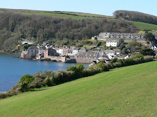
After a while, I descended out of the woods and left the Park heading for the seaside villages of Kingsand and Cawsand. Kingsand used to be part of Devon until 1844 and both villages have a long history of smuggling. Cawsand was particularly attractive with narrow side streets and interesting old properties. If it hadn't still been early, it would have been a nice place to stop, but I pressed on. It was a steep climb out of Cawsand up onto the clifftops heading first for Penlee Point and then Rame Head which I would subsequently be able to see for many, many miles ahead. The Official path passed right by Rame Head itself, which is often the case, but I made the detour up to the top where there was the ruins of a small Chapel and far reaching views back eastwards to Bolt Tail near Salcombe and my final destination westwards, The Lizard.

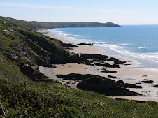
Once you are around Rame Head, you enter the long curve of Whitsand Bay which goes all the way to my day's final destination Portwrinkle. It was a nice walk from Rame Head down to the small cove of Polhawn. There were plenty of other walkers about, Rame Head had a nearby car park, so was obviously a popular day out. The first couple of miles of Whitsand Bay were fairly rocky - and the path winds along the cliffs through an area dotted with chalets. Although in great positions overlooking the Bay, they seemed very difficult to get to. For a while the path went along the main road behind the cliffs passing Whitsand Bay Holiday Park. This was obviously an ideal area for Para Gliding - and there was about 6 of them trying hard to launch themselves into the up currents.
Shortly after passing through a small place called Freathy the path headed inland and around a large military rifle range called Tregantle.
In fact, as firing was not taking place, I was able to take an alternative path through the range with great views down the long sandy bay of Long Sands nnd across the whole of Whitsand Bay! Tregantle Fort was part of the range and had been adapted for military accommodation.
It was not much further to Portwrinkle, and I got there about 2:00pm. I considered carrying on, but in the end, I was lured up to the small village of Crafthole where my bus would depart from. I had 40 minutes to wait, so headed for an inviting looking pub, The Finnygook Inn where I was just in luck - they had ONE Roast dinner left ( what's the name of thsi blog!!) Unfortunately they had run out of yorkshire puddings but you can't have everything. I sat outside - and an elderly couple near me proceeded to leave virtually their entire roast dinners and left their table. I was ravenous, and my dinner had hardly touched the sides - was it socially acceptable to grab their plates and help myself - ooh, I came so close.... in fact when the waitress collected the plates a few other drinkers in the beer garden joked about it. I think they had been unhappy about the vegetables - they were a bit crunchy, but good for your bowels no doubt!
Suitably refreshed, I hung around for a bus which NEVER arrived. I even asked one of the locals who was tending her front garden - she didn't know really, but offered to make me a cup of tea! - how kind was that, I said "No thanks, get me a can of Lager" In the end, after phoning Traveline - I decided to walk back towards Cremyll on the main road - and ended up doing another 6 miles to get to Millbrook where I finally caught a bus back to the Edgcumbe Arms.
Another day's walk over - I headed back over the Torpoint Ferry and rejoined the A38 back towards Uffculme.

South Walk: Wembury to Mt Edgcumbe

Saturday 11th April: Got to Wembury bright and early - plan was to leave the car there and get the bus back from Plymouth to pick it up later. The day's walk would take me all around the edge of Plymouth, so would be a bit different to the normal natural beauty of the coast.

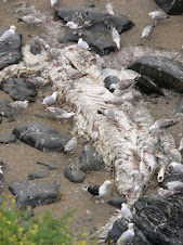
It was another glorious sunny day and I headed along the low cliffs above the long stretch of rocky beach which is known as Wembury marine conservation area. Unfortunately, that wasn't enough to save a Dolphin which had been washed up. I was surprised that it hadn't been removed as it looked as if it had been tagged in the past and normally they do a post mortem to find out what killed it - certainly it had been there awhile. The next wildlife was breathing - a nice friendly Chaffinch!

I headed on, passing an old military building - HMS Cambridge before quickly reaching Heybrook Bay which was surrounded by a modern residential area - almost a suburb of Plymouth. All the time, ahead, you could see right across the Sound to Cawsand Bay in Cornwall with Drakes Island in the foreground. it wasn't until the path passed around the point at Renney's Rocks and headed for the Holiday chalets at Bovisand, that you started to see the Docks of Millbay and Mount Batten Point . At Bovisand, you have the incongruous mix of a Holiday Camp and Fort Bovisand, one of 2 forts built to protect the harbour. It is now used as a Diving training centre. Until recently, the path to Mount Batten had been along busy roads, but the Coast Path Association had worked hard to create the current scenic path through woodlands and thenreached the open grassland area of Jennycliff Bay - which proved to be a good place for a Cappuccino pitstop.

A little further on you reach the landmark of Mountbatten Point with its jetty jutting out into the Sound. Formerly, a RAF Air Rescue centre, it was out of bounds until the late 1990's. From here, you can catch a Ferry to the Barbican and Sutton Harbour, but no short cuts for me! I could now see Plymouth in all it's glory with the lighthouse in full view on the Hoe. The path headed around the edge of the Sound towards Cattewater and Turnchapel passing alongside the busy new Marina area. From Turnchapel - the rest of the walk becomes very urban walking around the edge of Plymouth all the way to Stonehouse and the Ferry point across to Mount Edcumbe Park at Cremyll. Having said that, apart from the section crossing Laira Bridge and going through the Industrial area of Cattedown, it is an enjoyable walk and had has been much improved by Pymouth Council with the introduction of various unusual signs and pieces of art reflecting Plymouth's history along the way. The path from Turnchapel heads around Hooe Lake and past Radford Lake where you walk across a causeway and through the archway of an old lodge.

You are then onto one of the main roads into Plymouth, passing the well known landmark of the Oreston Rhino!

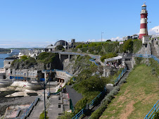
At Cattewater - the path rises through the industrial area and you get a good view across to Mount Batten - albeit a farily Industrial one! Eventually you can see the distinctive shape of the National Maritime Museum ahead of you, and the path literally passes right next to it and suddenly i found myself surrounded by people as the path went across the Sutton Harbour Lock gates to the popular old Barbican area. Suddenly, I felt a bit like a tourist, - but this was all fairly familiar territory for me as I headed to my left towards the Hoe. There were Ice cream vans bumper to bumper, as well as Francis Drake and his missus, strolling about as if he owned the place! - but then it was Easter weekend, I reminded myself! The path followed the foreshore next to the Royal Citadel and near to the Mayflower Steps. Of course Plymouth has a fantastic amount of history attached to it and as well as the obvious landmarks, there are some clever inscriptions and unusual artefacts, all marking historical events. Before long, I was on the promenade which became the Grand Parade, having passed Smeaton's Tower - the red and white lighthouse, which I had been seeing for several hours previous, in the distance. This had originally been positioned on Eddystone Reef but became unstable so was dismantled and rebuilt on the Hoe, whilst another working lighthouse was erected on Eddystone.
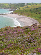
The view across the Sound spreads in both directions towards South Devon in the East and across to Penlee Point in Cornwall where I would be walking the following day.
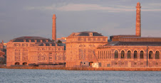
I headed for the Cremyll passenger ferry at Stonehouse via Devils Point and the massive Royal William Yard . I wanted to get across, sign in at the Edgecumbe Arms where I had booked a room for the night - and then get back to Plymouth and catch a bus out to Wembury to collect the car. I was beginning to wish that I had just left the car there all weekend - but my overnight things were in it. The Ferry ran every half hour - there was the unusual sight of a pair of swans nesting just at the top of the road down to the jetty - it was hardly a quiet spot, next to a Taxi rank! From the Ferry, you got a great view of the Royal William Yard part of the Navy victualling Dept which is now being converted into a Commercial and residential centre.

I spent an hour at Mount Edcumbe, sussed out my room at the pub, which was very comfortable and then headed back across. The journey back to Wembury was very frustrating. Missed a bus into Plymouth centre by 10 seconds so legged it only to have to wait best part of an hour for the next bus. It was late Saturday pm - so time to find a pub for the football results - Plymouth isn't your average seaside town. Firstly, I was ordered to remove my baseball cap which was plastered to my head, and then looking around me, apart from the women, I seemed to be the only person who had any hair! - and that's saying something. After a quick snifter, and feeling naked without a single tattoo - I waited at the bus stop and eventually got myself back to Wembury and drove back across via the Torpoint Ferry and then round to Cremyll.
It was Curry night at the Edgecumbe Arms - 6 varieties to choose from in great quantities - most of which seemed to go untouched - however my choice, Thai Green Curry was the most popular - and I got to finish it off with a second helping - so ensuring a jet propelled walk the following day!

Saturday, 16 May 2009

South Walk: Mothecombe to Wembury

Sunday April 5th: Back down to South Devon to pick up from where I last got to, which was Wonwell on the Erme Estuary. I was staying with my parents at Thurlestone, so we decided to drive to Noss Mayo, where I left my car and then they dropped me off back at Mothecombe which was across the estuary from Wonwell. It was a lovely morning, so they also decided to have a walk - but I left them to it and started up the path from Mothecombe estuary heading around Owen's point and to the small private beach which belongs to the Flete Estate. This used to be a popular walking and beach spot for our family, when Mum and Dad lived at Wrangaton and also Modbury. The estuary is one of the most unspoilt areas in Devon and provides great dog walking, when the tide is out.

The path headed up onto the clifftop for the pleasant walk to Gara Point at the mouth of the Yealm Estuary. The path passed through rolling pastures up and down between the various small rocky coves including the popular Wadham Beach which is fairly accessible from the nearby road.
Further on was the unfortunate sight of the static caravans at Stoke Beach and a diversion from here could take you to the remains of an ancient Church.

A little further on I reached the ruined coastguard lookout at Gunrow Downs and then shortly joined what is known as the 9 mile drive. This is now a wide pathway, but was originally built in the 1880's by unemployed fishermen for Edward Baring, who was Lord Revelstoke, as a path for the carriages going to his estate at Membland Hall.

As the path continues, you start to see the Eddystone Lighthouse in the distance - built on a large rocky islet off the Plymouth coast.
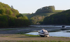
As the path turns inwards from Gara Point you have nice views of the Yealm Estuary which winds inland and is a popular sailing spot. The path ends at the village of Noss Mayo and across the Creek is the larger town of Newton Ferrers. The estuary was edged by woods and the path wound down to the waters edge and passed behind various riverside cottages and larger properties with superb views across to Warren Point and up the Yealm. During the season, a Ferry runs across on a regular basis. It was just my luck that the Ferry Service started for the season on Monday April 6th! - I was a day early, but I was aware of this, having rang the ferryman, the day before.
The ferry has a long history as seen by the old Toll Board. I carried on up the estuary path to Noss Mayo where I had left my car first thing. It was lunchtime and I was going to have a quick snifter at the pub, but it was packed out, so munched on a cheese sandwich in the car. The obvious plan was to take the car around the estuary and find somewhere to park not a million miles away from where the path started again at Warren Point across the water. So I headed back to the main road at Yealmpton and eventually got myself parked halfway between Wembury and Warren Point . I was fortunate enough to meet a local who showed me the best place to leave the car and described the way back. I was half way to Warren Point when I realised that I didn't have my camera! I then thought I had left it on top of the car! Traipsed back wasting time and energy - it was inside the car - so worry over. So I headed for Wembury . This would be an easy place to resume my walk next time, being on the bus route also from Plymouth. The walk was uneventful, but it was still a lovely day, so there were plenty of day trippers about. Wembury beach is very popular being nice and sandy - and also popular for surfers when the conditions are right. The village is set back inland, but there are good National Trust facilities at the Beach as well as a splendid old Church up on a small hill. Apparently, the Church Tower is still used as a landmark for ships and yachts entering the Yealm Estuary.
After a short break - I headed across an inland path in the vague direction of the car - and apart from one wrong detour, it didn't take too long to reach it . A few more miles done - I would be back, bright and early the following Saturday!

Thursday, 14 May 2009

North Walk: A Walking Week - Port Isaac to Hayle - Day 5 - Portreath to Hayle

Friday March 20th: In an ideal world, I had wanted to reach St Ives at the end of this weeks walking, but I also needed to get back to my car by Public Transport , so the day revolved around making sure I got back to Truro in time to catch the last connection back to Port Isaac and trying to reach St Ives would mean missing that bus!

It was a 12 mile walk to Hayle, another gorgeous day and I headed off back up to the cliffs and across an area known as Reskajeage Downs. This was a rocky stretch with many small rock islands just offshore and I had Navax Point in my sights for several miles. The main road between Hayle and Portreath ran quite close to the path with several cliff car parks, so it was a popular walking spot.

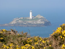
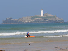
Navax point was at the tip of a headland known as the Knavocks, a wildland area maintained by the National Trust. From here you got a good view of Godrevy Island and it's lighthouse, built in 1859 and now solar powered. The path headed out from Navax Point to Godrevy Point which was an area well now for Seals. In fact I had been here before and seen seals, and wasn't disappointed this time either. There is an excellent Cafe at the Car park at Godrevy and I had a brief stop before crossing across the Red River near to the village of Gwithian. The massive St Ives bay was laid out before me - which stretched around for miles all the way beyond Hayle, merging into Carbis Bay and to Portminster Point, just before St Ives. There were two options - either across the beach or along the path through the dunes behind. I opted to do a bit of both starting off in the dunes - and then dropped down onto the beach at the first opportunity. Nearing an area known as Black Cliff near the mouth of the estuary inlet to Hayle I went back into the Dunes as per my guide book but the path became a bit confused through an area of holiday chalets and I ended up heading inland towards Hayle having missed the correct path around the headland. Because I was short of time, I couldn't retrace my steps - so will have to do that last bit into Hayle on my next visit.

Hayle itself was nothing to write home about - and suffers even more in comparison to St Ives just up the road (or coast!) I had planned to get a train to Truro from Hayle but in the end jumped on a bus - not realising that it went all over Cornwall - so I very nearly missed my Truro bus connection - then thought I would have to change buses 3 times to get to Wadebridge, but in fact the bus just changed it's number at different points! Had a bit of a wait at Wadebridge before getting the last bus back to Port Isaac - and the car was still there - all 4 wheels intact! I had walked about 75 miles in 4 and a half days - so made pretty good progress - and chose the best week of the year weather wise!
Wednesday, 13 May 2009

North Walk: A Walking Week - Port Isaac to Hayle - Day 4 - Perranporth to Portreath

Thursday March 19th : Left Perranporth on another sunny morning. Up on the cliffs there were many reminders of the areas Mining history. In fact the whole cliff walk to St Agnes was littered with old mine shafts capped with conical metal cages The main metals mined were Tin and Wolfram ( tungstate of Iron) - but at some points the cliffs were a pinky orange colour of iron and arsenic. It was a fantastic walk to St Agnes - sheer cliffs, stunning colours and marine blue water below.

I was surprised to suddenly come across a couple of Pub style Picnic Tables plonked right next to the clifftop and chained to the ground! The owner was obviously concerned about gangs of scouse seagulls swooping down and carrying them off, I thought. However - a little further on, I could see that I was walking alongside an Aerodrome, so it belonged them methinks.

Further on there was a steep walk down to Trevellas Porth and then an even steeper climb out of the cove towards Trevaunance Cove which is the beach and old harbour area of St Agnes a half mile inland. This is still a working fishng area - mostly lobsters and crabbing although it has a long history of pilchard fishing. On climbing out of Trevaunance Cove - the path is once again at high level heading towards St Agnes Head where there were fine views in all directions and with the sheer high cliffs - lots of swirling sea birds

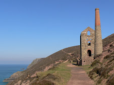
A little further on, I came across the well known landmark of Towan Roath Mining shaft which has been restored by the National Trust and also appeared on the cover of Du Maurier's book "Vanishing Cornwall" The imposing structure is right on the path and made the cliffs even more dramatic as you looked back on it from further on.
There was a welcome Pitstop at the next cove - Chapel Porth, where the various old Mining buildings have been converted into visitors amenities.
It is a popular spot - particularly for surfers - good beach breaks apparently. Well I was after a snack break - and there was a lovely cafe offering their specialty Hedgehog Ice Cream Cone! - fortunately, it looked like a Hedgehog as opposed to tasting like one.
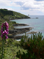
Another steep walk from here and once again the path is littered with old Mining workings. Also - some very colourful pink cliffs which made for some unusual photos. The next place of note reached was Porthowan where I indulged myself with caffeine top up. There was plenty of people about for a midweek out of season day - but I was soon on my way for the 4 mile walk to Portreath.
it was high cliffs all the way, with numerous old mine workings. I was undecided whether to stay at Portreath that night or carry on a bit further. It was still quite early - but would have meant a longish walk to find any accommodation, so in the end, I wandered around trying to find somewhere suitable to stay. In the end - the local Inn - The Bassett Arms proved to be both a good watering hole and comfortable overnight stay. Food wasn't bad either. Portreath used to be a very busy port in the 19th Century - and used to be called Bassetts Cove after the Bassett's who helped fund the building of the harbour which helped their mining businesses. Now, it seemed a rather strange place - apart from the main beach, there was also a second small area of sand beyond the harbour wall right next to a pub called the Waterfront which sounded alot better than it looked and really only fronted a small patch of sand and to all intents and purposes was in the middle of a housing estate. I think it was the locals dive. Portreath also had a Chinky Takeaway which was tempting - but in the end I decided to back British!
Sunday, 26 April 2009

North Walk: A Walking Week - Port Isaac to Hayle - Day 3 - Newquay to Perranporth

Day 3 Wednesday March 18th Woke up to to a foggy Newquay, which I was quite glad of - seeing as I was resembling an over-ripe tomato. Had forgotten to pack suncream - and it was proving to be one of the sunniest weeks of the year especially in North Cornwall.
Breakfast proved eventful at The Cavendish hotel. There was a large group of wrinklies on tour and staying at the Hotel - probably the "Over 80's Nude Surfing Club" or somesuch and they were first down for breakfast, but also not far behind them were various people all sporting CCS T shirts on a Company Piss up. They staggered into breakfast looking worse for wear - some still clutching bottles of beer! One of the blue rinse brigade rose from her table, marched over to a tableful of hung over individuals and proceeded to give them a blast of her tongue - along the lines of how inconsiderate they were to have been causing a rumpus at 4am in the morning after a night on the lash. They stared at her aghast - too bleary eyed to respond - and she returned to her table to a standing ovation and hurrahs all round.

I had a slow start to the morning - I had to cross the River Gannel which is just South of Newquay and there is a walkway whcih can be accessed 2 hrs either side of low tide - so I thought that would be about 11am ish - so meanwhile - I got myself to the chemist for some Factor 50 - plus a tube of Lip Salve. Standing outside the chemist, I ripped the packaging off and chucked it in a large Council bin - unfortunately, I was left holding an empty plastic tube and had to then dip my arm into a pile of festering waste to try and find it! The path went through the centre of Newquay and past the old Harbour, so I walked down and had a look, but there didn't seem to be much happening.

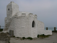
I rejoined the path and headed up towards Towan Head. At the head o the harbour was an interesting old building known as a Huers Hut. Dating back to 14th century - this was used by lookout men to spot shoals of pilchards and they then alerted and directed the local fishing boats.
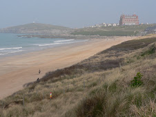
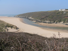
My view from Towan Head was spoilt by the fog - but it was starting burn off as I walked back from the head to the start of Fistral Beach - Newquay's famous Surfing mecca. Conditions for surfing didn't look that good, but there were a few people catching the waves at both ends of the long beach. From the far end of Fistral -the path went out towards Pentire Point East, where there was a superb house built into the cliffs with helicopter landing pad and half built swimming pool. I was now at the mouth of The River Gannel and there were several alternative routes to cross it including a small Ferry in the high season. I headed for the footbridge mentioned earlier and the path went through the suburban area of Fern Pit and there was some lovely property overlooking the estuary, which was very beautiful in the early morning sun.
Across the river, the path then wound behind Crantock beach and climbed back up to the clifftop at Pentire point West. The small sandy bay of Porth Joke followed before reaching another popular and more secluded surfing spot - Holywell Beach. It is so named because in the past - there was a trickle of water from a small cave which was thought to have healing properties and sick children were brought along to be dipped in the water.
The path then skirted around a large and ugly army camp at Penhale where there were some unusual looking clifftop radar equipment, before going out to Ligger point with some great views and then you reach the massive long beach of Perran. It was then a choice of scrabbling through the soft sand of the dunes - or the firm sand of the beach - so that was a no-brainer! The beach seemed to go on forever, reminding me of Saunton Sands - but eventually I reached the small seaside town of Perranporth. Originally, I had planned to try and get to St Agnes - but I was fairly footsore, so given that there was a good choice of accommodation - I decided to call it a day. There was also a good beachside cafe - so I took the opportunity to stuff a Cream tea in my face before phoning around for a B&B.
I found one - small grotty smelly single room -I was the only occupant and they were advertising NO VACANCIES - but the man I spoke to on the phone had said YES we have a room I think, but my wife deals with this and proceeded to laugh nervously! Wife wasn't amused to return from the Supermarket to find that hubby had taken someone in - she wasn't prepared! - the perils of finding accommodation, out of season! At least they had a bath. I later hit the town and tried to find somewhere to eat - the first pub stopped serving food at 6.oopm! - bizarre - but not worth employing a chef to stand around scratching his bollocks all evening, I suppose. Anyway, they recommended another much busier pub, The Green Parrot where I had an excellent meal. Probably only about 13 miles walked today - but an enjoyable hike - and I would head for Portreath in the morning.

Saturday, 25 April 2009

North Walk: A Walking Week - Port Isaac to Hayle - Day 2- Trevone to Newquay

Day 2 Tuesday March 17th: As the Sole occupant at The Well Parc, Trevone - I felt a bit guilty that someone came in specially to cook my breakfast - I would have done it myself if they'd asked.
After she had cleared up, she cleared off - and the place seemed deserted. I didn't make a good start to the day - was half way down the road back to the path when I realised that the Room Key was still in my pocket - went back - only a friendly dog to greet me - gave him the key and set off again. Got to the beach and realised that my water bottle was still sitting back in my room. Tramped back in a huff - had to get the dog to let me back into my room - and made my third exit. If I'd been a scouser and not had 18 miles to walk - I could have left with the 42" wide plasma screen strapped to my back!

It was another scorcher of a day as I finally made my way, Newquay was my destination. A little further on from Trevone was Harlyn Bay and on the way, I passed a large flock of Oyster catchers quite close to shore plus another "Round Hole". I didn't look in it, but I hoped it wasn't full of Tesco shopping trolleys and fridges! Looking back - you got the best view of Trevone's Round Hole - like a scar on the cliff face.
For some miles - I had been able to see the light house at Trevose Head - and this was my first point to head for. Having rounded Cataclews Point there was the unusual sight of Padstow Lifeboat Station - seemingly built into the cliffs in the middle of nowhere.

Around the point and the Lighthouse was reached - built back in 1847 - it was a landmark that I would look back and see all day. a little further one - I was convinced that could see a Seal just off the rocks at Stinking Cove!. I spent quite awhile taking pictures - until I realised it was either a seal shaped rock - or a dead seal - still not sure which.

I was now heading due South with Mawgan Porth and then Newquay in my sights. The path passed behind the large bays of Booby's and Constantine which merged into each other -and were apparently unsafe for bathing - although they looked very inviting.

Between here and Portcothan were a series of small coves and inlets - and it was very scenic with dramatic rocks just off the beach - known as Minnows Islands.

I was soon at Portcothan, a small village which had a nice beach and was a lovely isolated spot. I didn't stop, and the path headed out towards the headland overlooking the small Trescore Islands.

The following few miles were hard work but also breathtakingly beautiful and included the wellknown landmark of Bedruthan Steps. This was my first visit, but I could see that in the Summer, it would be a major attraction - so I was pleased to see it with few people about, and on a sunny day. There were a series of sandy beaches with large rock stacks and small islets. From here, it was pretty much downhill all the way to Mawgan Porth. I was now underneath the flight path of incoming aircraft to Newquay Airport - and I was suprised at how frequent they were.
Mawgan Porth is one of North Cornwall's most popular spots and an ideal place for a coffee stop - one of the better Cappuccinno's was duly dispatched overlooking the large bay. As I left the bay - a couple of horses were taken onto the beach - and were being enticed into the sea - but it was pretty obvious that the horse did NOT want a paddle - so it was quite amusing watching the ensuing struggle - you can lead a horse to water, but you can't make it .....


A little further on, I reached the start of the long beach of Watergate Bay - one of the longest on this part of the coast. A popular surfing spot of course - it was so big - I couldn't see it ever being packed! A third of the way down the bay - the path crossed the road behind the well known Watergate Hotel where Jamie Oliver has his restaurant 15.

The path climbed back up to the tall cliffs and I now had Newquay in my sights and I was keen to get there in good time to find a suitable B&B. At the end of Watergate Bay was Trevelgue head and Porth Sands just on the outskirts of Newquay. There was a small wooden bridge which linked Trevelgue to the mainland and it used to be the site of an Iron Age castle.

I was now definitely away from Cornwall's natural beauty and had reached Cornwall's largest holiday resort - a mecca for the surfing brigade. By this time, I was well tired and looking forward to a hot bath and putting my feet up. The path eventually ended up on the main road into Newquay centre and I kept my eyes open for suitable accommodation. Down a small side road, I spotted a large and tired looking Hotel - it was cheap and cheerful - had a room with a bath - so that would do for me. The friendly old lady from up North on reception was a bit suprised at me hobbling about like a cripple, and even more suprised when I said that I had walked from Trevone, but then she probably never walks further than the Chip Shop.
Later on, I found a busy City centre pub doing a Steak and chips special with a Free Pint so I was well happy. The next day - I would head for Perranporth.

Sunday, 19 April 2009

North Walk: A Walking Week - Port Isaac to Hayle, Day 1 - to Trevone

Day 1 Monday March 16th : After much consultation with online bus timetables trying to plan out my weeks walking and ferrying backwards and forwards to my car - the obvious decision was to leave the car at the start for the whole week - as I had already ascertained that I could buy a full weeks ticket at the car park in Port Isaac - so that's what I did. Another early start on the road from Uffculme - and I was back on the path at Port Isaac by 9:00am. The weather was good - and in fact the forecast was for sun all week - so I had struck lucky for once. The plan was to get to Rock and then across the River Camel by ferry to Padstow, and depending on what time it was - carry on from there to Trevone and find somewhere to stay. I was familiar with part of this coastline, from staying at Ron and Melanie Ward's bungalow at Polzeath a few years back. In fact they had been quite keen to do some walking with me on this stretch - but it didn't quite work out timing wise.
The morning's target was to get to Pentire Point - which is a magnificent viewpoint in both directions.

Before that - there was some quite strenuous walking to be done. There was only one coastal village along the way - Port Quin which was a lovely secluded place offering nothing in the way of refreshment apart from a cold water drinking tap. The village used to be quite a successful fishing village - but alot of the village was abandoned eyars ago - and now there are just a few National Trust cottages and a large stone house wonderfully positioned at the edge of the small beach commanding the best position- probably the harbourmasters house.

Another point of interest was Lundy's Hole - a natural passageway eroded through the cliff . At various points on the way to Pentire Point and what they call The Rumps - you could get a vantage point looking South West beyond the Camel estuary to Stepper Point which I would reach later in the day. The Rumps was a rocky headland stretching out Northerly and in theory the official path didn't include it - but it looked a dramatic place for a good photo - so I diverted off the path and climbed to the highest point.

Just off the point was a large rock known as The Mouls which has been home to Puffins.

From here it was a short walk round the headland to Pentire Point with some of the most far reaching views so far on this Cornish coast. I could now see Polzeath and a glimpse of Padstow itself. From here - the path was all downhill to Hayle Bay - and the sandy beach of Polzeath - another popular surfing beach. Another short walk across the cliffs brought me to Daymer Bay - and as it was low tide - I was able to take the route along the beach although it meant I missed seeing St Enodoc Church which has quite a bit of history and was apparently once completely engulfed by sand! The beach walk took me all the way to Rock itself , although I didn't see much of it - as I walked straight from the beach onto the Ferry. I was quite foot weary by now - and was looking forward to some refreshments at Padstow - a cream tea had been lingering in my thoughts for a few miles - and I wasn't disappointed. The ferry dropped off further down the estuary as it was high tide - so it was a few hundred yards back to the Harbour where I dived into the nearest Tea Room, which to my astonishment didn't seem to be owned by Rick Stein - and wasn't offering fish flavoured scones!

It recharged the batteries, and as it was quite early afternoon - I could easily make another 5-6 miles onto Trevone. I decided to see if the Tourist Office could book me some accommodation at Trevone - and between us, I found somewhere - The Well Parc Inn. I didn't really have time to look round Padstow much - but it is somwehere I've been to before, so didn't bother me.

The path left the harbour and headed out to the head of the estuary at Stepper Point which looked straight out to Pentire. It was a nice walk in the afternoon sun taking me past various coastguard cottages and also some old pilot cottages which were lived in by the men who guided vessels in and out of the estuary. The path took an inland diversion around an inlet before heading up to the tall stone Daymark at Stepper Point - which had been in view for many miles previous and was an old shipping positional aid.

A little further on - I met another hiker coming in the opposite direction - we stopped and had a chat - he had walked from Newquay and was heading for Padstow - that was probably going to be 23 miles - so he was quite knackered - but in fact as I would find out the following day - the path to Newquay was reasonably flat in comparison to some stretches.

I headed on to Trevone - the sun was going down quite quickly now and the light was superb for photography - and there were some wonderful rock formations at Gunver Head and Porthmissen. As you reach the head at Trevone Bay - there is a massive hole on the Cliff Top - which is a bizarre sight. Some genius has named this Round Hole - and they are quite common apparently - but this is a particularly large one - they are caused by sea erosion - all to do with soft rock seeping out from underneath a band of hard rock in front of it - eventually - ie a year or million later - you get a large hole which young children can fall into.
I was glad to reach Trevone and dying to get the boots off - had walked 18 miles or so - the Well Parc was half a mile from the beach - it was the locals pub as well as a hotel - the man sitting at the bar looked familiar - and he recognised me - he had served me my Cream tea at Padstow! The room was very comfortable with great views out to sea - but they'd probably given me the best one - I was the only one there!

After a good soak in the bath -I headed for the empty bar and ordered some food with a little trepidation. After a while a few locals bowled in - it was Whist Drive night - so plenty of excitement - I buried a few pints, stuffed my face with fish and chips and then headed for the pit.

Friday, 10 April 2009

South Walk: Salcombe to Wonwell

Thursday March 5th. Taken a couple of days off work - so headed down to Mum and Dad's at Thurlestone to pick up the path at Salcombe again. This is a section of the path that I know very well - and has always been one of my favourite parts of Devon, but it had been quite a few years since I had walked out from Salcombe. Dad dropped me off at North Sands beach, where the path officially started again - it was a lovely sunny day, although with a bitterly cold wind and I headed past South Sands and climbed up towards the National Trust gardens of Overbeck. The Salcombe estuary has some superb properties with magnificent views, - some of the most expensive real estate in Devon. Also at Overbecks is a Youth Hostel - they really do have some prime locations - this YHA lot.

The path continued out towards Bolt Head - a prominent rocky point and then there was a very scenic stretch to Soar Mill Cove. As children we had often come to this beach, as it is very secluded and difficult to get to - but lovely once you are there. It was a steep climb out from Soar Mill Cove and feeling a bit sweaty, I made the foolish decision to take my trouser legs off!

It wasn't long before I was on the exposed stretch of Bolberry Down - and the bare legs took a pounding. There wasn't many walkers - but the few I did meet were wrapped up in Arctic clothing and some raised an eyebrow or two at the rambling loony in shorts.

Mum had decided to meet me on the path near Thurlestone and walk with me to Bantham.

I reached Hope Cove ahead of schedule - so visited the Hope and Anchor and had a ( guess what!) quick Cappuccino before meeting Mum on the footbridge beyond South Milton sands, one of Thurlestone's 3 beaches. The South Hams coast has been kept very unspoilt by the planners - so they take some credit for that - and Thurlestone has remained very untouristy, although they are just in the process of creating a new car park and shoring up the back of the beach and improving the small cafe at South Milton. Mum and I walked the well trodden path around the edge of the Golf Course - Thurlestone's main attraction, although deemed to be one of those snobby golf courses it has a great location but is very open to the elements.
Soon we were looking out towards Burgh Island off Bigbury beach as we dropped down the steep path to Bantham. The view here is superb - with all the waves rolling in towards the Avon Mouth estuary, the expanse of sand and the Island itself which is accessible by foot at low tide, and has the famous Tractor which ferries people back and forth to Bigbury when walking is no longer an option. The Island is well worth a visit - having a 650 year old Inn plus the famous Art deco Hotel once visited by Agatha Christie and features in some of her books. Not today though - once we had reached Bantham itself - we phoned for the Taxi service - which was Dad. At Bantham you are faced with crossing the River Avon - not an option even at low tide .

There is a Ferry service which runs during the peak months, but I was in the fortunate position of being given a lift over to the other side. Mum left me to it - and I got dropped off at the other side near the Bigbury Golf Course. What I thought was a quick walk down to pick up the path again at the Ferry point at Cockleridge turned out to be a 2 mile hike and I was starting to feel a bit leg weary. The aim was to reach Wonwell where there was another estuary to cross, by the end of the afternoon- and I could be picked up from Kingston - the nearest village inland.
After passing through Bigbury and then the awful mobile home eyesore of Challaborough I seemed to be suffering a leg strain - which I later put down to the wind chill bare legs factor! It wasn't a long way to reach Wonwell, but there were some steep ups and downs and by the time I had passed through Ringmore and Aymer Cove , my legs had had enough and I could see that I would be getting to Kingston very late - so I took the next inland path to Kingston which was a long and extremely muddy track .

I was praying that the pub, - the Dolphin Inn would be open with a roaring log fire, but I was disappointed and had to wait outside for my lift back to Thurlestone. Mum came armed with a can of lager and a packet of crisps - but by that time, what I really needed was a hot bath and a buxom masseuse to soothe my aching muscles!

Sunday 8th March : Annoyingly, I now had just a few miles to walk to get to Wonwell and the Erme Estuary, and it wasn't going to be worth going much further, so I decided to just make a mornings walk out of it as a round trip from Kingston back to the coast, along to Wonwell and then back inland again to Kingston. Normally, that would be a nice round trip walk to do on a Sunday morning, but for me it was alot of walking but only a few miles to add to my total! I had rested my leg strain for a couple of days anyway - so wanted to take it a bit easier AND as it happened, the heavens opened late morning - just as I got back to my car - so I avoided a big soaking. The sun was shining again and this part of the coast is quite distinct with it's steel grey steep slate cliffs - so it was a very pleasant walk. The Erme Estuary at Wonwell, looking across to Mothecombe is one of the most unspoilt estuaries on the whole of the SW path and is a lovely setting at low tide, very popular with dog walkers, in fact as a family we used to often come here and walk the dogs, particularly when my parents lived at Wrangaton. The estuary is crossable at low tide - but I would be coming back again and starting from the other side another day. It was back to Thurlestone for another Sunday Roast - ( what's this blog's web address!!)